Asprópyrgos night lights from space
Night Light of Asprópyrgos (Attica) from space (Greece) Src. Average luminocity for 10x10km area is 84.414% and for 50x50km: 39.9709%.

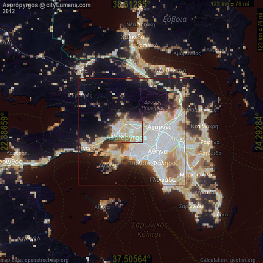
Analysis of Asprópyrgos night lights 2016
Square area 10x10 km:
 23.05%
90-99
27.76%80-89
14.94%70-79
17.37%60-69
4.55%50-59
4.71%40-49
7.47%30-39
0.16%20-29
0%10-19
0%0-9
0%Square area 50x50 km:
12.45%90-99
8.8%80-89
3.99%70-79
4.67%60-69
4.77%50-59
3.52%40-49
4.19%30-39
4.53%20-29
6.03%10-19
10.55%0-9
36.49%Clear (daylight) street map image can be seen on geolist.org.
Map coordinates:
38° 36' 46.3" North, 22° 53' 11.7" East
38° 3' 40.8" North, 23° 35' 23" East
37° 30' 20.3" North, 24° 17' 34.2" East
Some cities around Asprópyrgos sort by population:
• Ílion
10.1 km =6.3 mi,  107°
107°
• Korydallós
9.9 km =6.2 mi,  149°
149°
• Petroúpolis
8.6 km =5.3 mi,  104°
104°
• Chaïdári
8.7 km =5.4 mi,  129°
129°
• Áno Liósia
10 km =6.2 mi,  75°
75°
• Kamaterón
10.1 km =6.3 mi,  93°
93°
• Elefsína
4.7 km =2.9 mi,  241°
241°
• Mándra
7.9 km =4.9 mi,  274°
274°
264445 (p: 30,251)
Sources (retrieved 2019-11-25):
» Earth at Night: Flat Maps 2012, 2016