Ílion night lights from space
Night Light of Ílion (Attica) from space (Greece) Src. Average luminocity for 10x10km area is 96.9269% and for 50x50km: 47.9576%.
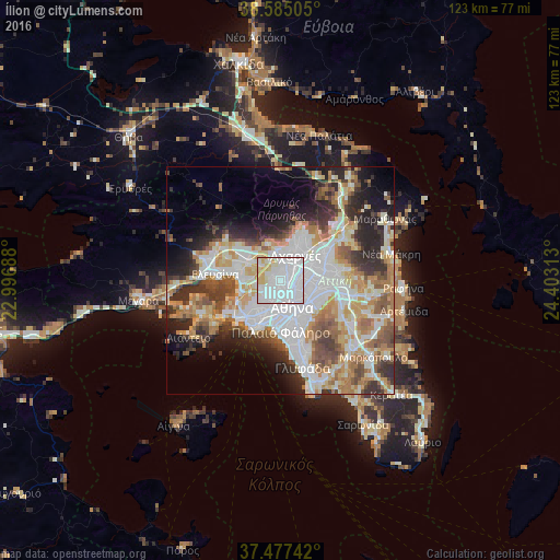
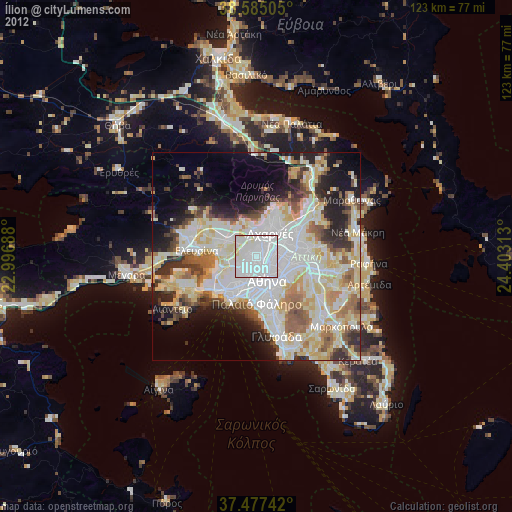
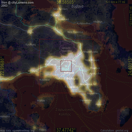
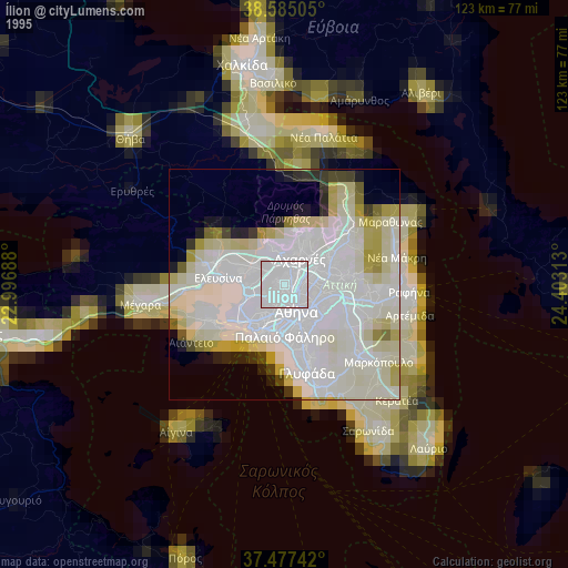
Analysis of Ílion night lights 2016
Square area 10x10 km:
 70.13%
90-99
16.23%80-89
7.63%70-79
6.01%60-69
0%50-59
0%40-49
0%30-39
0%20-29
0%10-19
0%0-9
0%Square area 50x50 km:
13.37%90-99
10.98%80-89
4.96%70-79
6.55%60-69
6.79%50-59
4.88%40-49
5.1%30-39
5.58%20-29
8.32%10-19
8.09%0-9
25.39%Clear (daylight) street map image can be seen on geolist.org.
Map coordinates:
38° 35' 6.2" North, 22° 59' 48.8" East
38° 1' 60" North, 23° 42' 0" East
37° 28' 38.7" North, 24° 24' 11.3" East
Some cities around Ílion sort by population:
• Peristéri
2.1 km =1.3 mi,  199°
199°
• Petroúpolis
1.6 km =1 mi,  305°
305°
• Chaïdári
3.9 km =2.4 mi,  230°
230°
• Ágioi Anárgyroi
2.1 km =1.3 mi,  99°
99°
• Kamaterón
2.5 km =1.6 mi,  10°
10°
• Néa Filadélfeia
3.3 km =2.1 mi,  86°
86°
• Néa Chalkidóna
2.8 km =1.7 mi, 104°
• Zefyri
4 km =2.5 mi,  22°
22°
256601 (p: 84,793)
Sources (retrieved 2019-11-25):
» NASA, Earths city lights 1995
» NASA city lights 2003
» Earth at Night: Flat Maps 2012, 2016