Siguiri night lights from space
Night Light of Siguiri (Kankan) from space (Guinea) Src. Average luminocity for 10x10km area is 1.6991% and for 50x50km: 0.4102%.
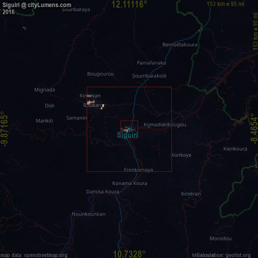

Analysis of Siguiri night lights 2016
Square area 10x10 km:
 0%
0%90-99
0%80-89
0%70-79
0%60-69
0%50-59
0%40-49
0.65%30-39
1.3%20-29
3.25%10-19
0%0-9
94.81%Square area 50x50 km:
0.02%90-99
0.02%80-89
0.05%70-79
0.05%60-69
0%50-59
0.2%40-49
0.03%30-39
0.15%20-29
0.23%10-19
0.07%0-9
99.18%Clear (daylight) street map image can be seen on geolist.org.
Map coordinates:
12° 6' 40.2" North, 9° 52' 17.9" West
11° 25' 22.2" North, 9° 10' 6.7" West
10° 43' 58.1" North, 8° 27' 55.4" West
Some cities around Siguiri sort by population:
• Kankan
116.3 km =72.3 mi,  187°
187°
• Bougouni, ML
183.7 km =114.1 mi,  90°
90°
• Kangaba, ML
99.6 km =61.9 mi,  55°
55°
• Kouroussa
116.1 km =72.1 mi,  222°
222°
• Kokofata, ML
183.3 km =113.9 mi,  332°
332°
• Mandiana
102.6 km =63.8 mi,  149°
149°
• Dinguiraye
168.9 km =104.9 mi,  265°
265°
• Kita, ML
182.6 km =113.5 mi,  348°
348°
2415703 (p: 43,601)
Sources (retrieved 2019-11-25):
» Earth at Night: Flat Maps 2012, 2016