Teshi Old Town night lights from space
Night Light of Teshi Old Town (Greater Accra) from space (Ghana) Src. Average luminocity for 10x10km area is 69.4442% and for 50x50km: 43.5164%.
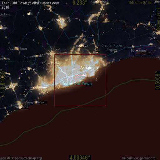
Analysis of Teshi Old Town night lights 2016
Square area 10x10 km:
 38.02%
90-99
13.84%80-89
3.1%70-79
1.24%60-69
7.85%50-59
1.03%40-49
5.17%30-39
4.96%20-29
13.64%10-19
8.88%0-9
2.27%Square area 50x50 km:
14.71%90-99
9.47%80-89
8.69%70-79
5.44%60-69
4.08%50-59
2.61%40-49
3.09%30-39
2.33%20-29
4.33%10-19
4.58%0-9
40.66%Clear (daylight) street map image can be seen on geolist.org.
Map coordinates:
6° 16' 58.8" North, 0° 48' 37.3" West
5° 35' 1.1" North, 0° 6' 26" West
4° 53' 0.5" North, 0° 35' 45.2" East
Some cities around Teshi Old Town sort by population:
• Accra
10.4 km =6.5 mi,  252°
252°
• Atsiaman
27.6 km =17.1 mi,  297°
297°
• Tema
13.9 km =8.6 mi,  46°
46°
• Medina Estates
11 km =6.8 mi,  325°
325°
• Nungua
3.9 km =2.4 mi,  59°
59°
• Dome
16.1 km =10 mi, 297°
• Gbawe
22.5 km =14 mi,  268°
268°
• Aburi
30.3 km =18.8 mi,  345°
345°
2294665 (p: 144,013)
Sources (retrieved 2019-11-25):
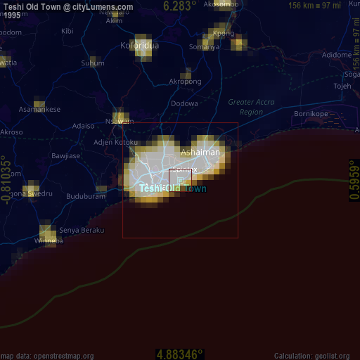
» NASA, Earths city lights 1995
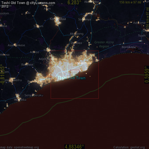
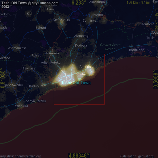
» NASA city lights 2003
» Earth at Night: Flat Maps 2012, 2016