Nungua night lights from space
Night Light of Nungua (Greater Accra) from space (Ghana) Src. Average luminocity for 10x10km area is 68.4959% and for 50x50km: 41.3819%.
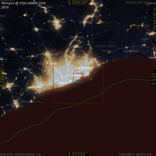
Analysis of Nungua night lights 2016
Square area 10x10 km:
 34.71%
90-99
11.57%80-89
3.72%70-79
6.4%60-69
7.44%50-59
1.03%40-49
5.79%30-39
5.58%20-29
13.64%10-19
8.26%0-9
1.86%Square area 50x50 km:
14.2%90-99
8.87%80-89
7.23%70-79
4.91%60-69
4.09%50-59
2.43%40-49
3.37%30-39
2.91%20-29
5.18%10-19
5.39%0-9
41.42%Clear (daylight) street map image can be seen on geolist.org.
Map coordinates:
6° 18' 1.4" North, 0° 46' 48.9" West
5° 36' 3.8" North, 0° 4' 37.7" West
4° 54' 3.2" North, 0° 37' 33.6" East
Some cities around Nungua sort by population:
• Accra
14.2 km =8.8 mi,  249°
249°
• Atsiaman
29.8 km =18.5 mi,  291°
291°
• Tema
10.2 km =6.3 mi,  41°
41°
• Teshi Old Town
3.9 km =2.4 mi,  239°
239°
• Medina Estates
11.9 km =7.4 mi,  307°
307°
• Dome
18.4 km =11.4 mi, 287°
• Gbawe
26 km =16.2 mi,  264°
264°
• Aburi
29.5 km =18.3 mi,  338°
338°
2296969 (p: 70,483)
Sources (retrieved 2019-11-25):
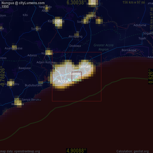
» NASA, Earths city lights 1995
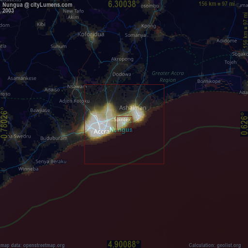
» NASA city lights 2003
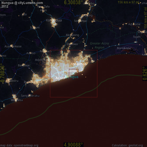
» Earth at Night: Flat Maps 2012, 2016