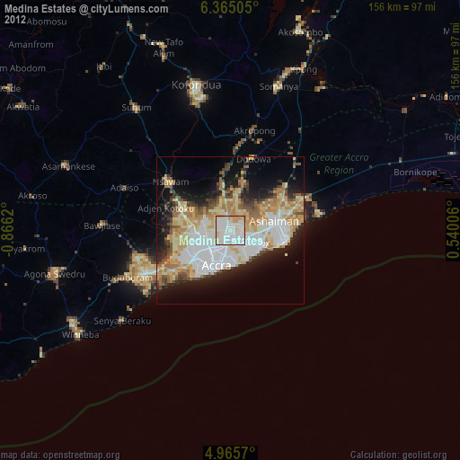
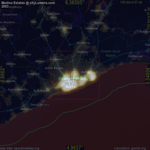
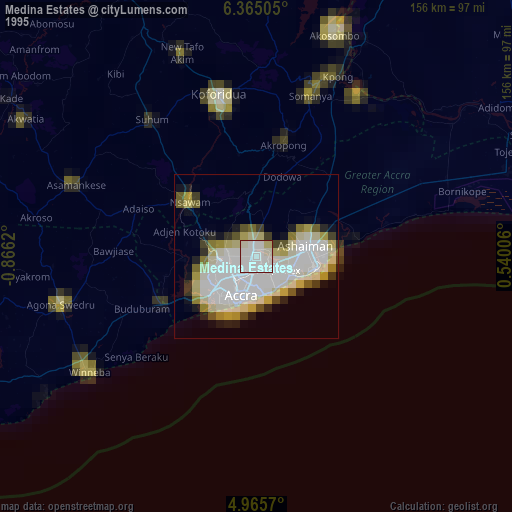
Medina Estates night lights from space
Night Light of Medina Estates (Greater Accra) from space (Ghana) Src. Average luminocity for 10x10km area is 98.7231% and for 50x50km: 52.274%.

Analysis of Medina Estates night lights 2016
Square area 10x10 km:
 63.84%
90-99
34.3%80-89
1.86%70-79
0%60-69
0%50-59
0%40-49
0%30-39
0%20-29
0%10-19
0%0-9
0%Square area 50x50 km:
15.01%90-99
9.81%80-89
10.85%70-79
7.2%60-69
5.98%50-59
4.17%40-49
5.1%30-39
4.42%20-29
6.67%10-19
8.44%0-9
22.35%Clear (daylight) street map image can be seen on geolist.org.
Map coordinates:
6° 21' 54.2" North, 0° 51' 58.3" West
5° 39' 56.9" North, 0° 9' 47.1" West
4° 57' 56.5" North, 0° 32' 24.2" East
Some cities around Medina Estates sort by population:
• Accra
12.8 km =8 mi,  197°
197°
• Atsiaman
18.6 km =11.6 mi,  281°
281°
• Tema
16.2 km =10.1 mi,  88°
88°
• Teshi Old Town
11 km =6.8 mi,  145°
145°
• Nungua
11.9 km =7.4 mi,  127°
127°
• Dome
8.3 km =5.2 mi,  257°
257°
• Gbawe
19.1 km =11.9 mi,  238°
238°
• Aburi
20.3 km =12.6 mi,  356°
356°
2298330 (p: 101,207)
Sources (retrieved 2019-11-25):
» NASA, Earths city lights 1995
» NASA city lights 2003
» Earth at Night: Flat Maps 2012, 2016