Chiat’ura night lights from space
Night Light of Chiat’ura (Imereti) from space (Georgia) Src. Average luminocity for 10x10km area is 0.3758% and for 50x50km: 0.5057%.
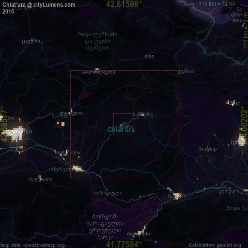
Analysis of Chiat’ura night lights 2016
Square area 10x10 km:
 0%
0%90-99
0%80-89
0%70-79
0%60-69
0%50-59
0%40-49
0.61%30-39
0%20-29
0.15%10-19
0.45%0-9
98.79%Square area 50x50 km:
0.04%90-99
0.03%80-89
0.12%70-79
0.06%60-69
0.05%50-59
0.08%40-49
0.13%30-39
0.1%20-29
0.03%10-19
0.1%0-9
99.26%Clear (daylight) street map image can be seen on geolist.org.
Map coordinates:
42° 48' 57.5" North, 42° 35' 44.8" East
42° 17' 53" North, 43° 17' 56" East
41° 46' 33" North, 44° 0' 7.3" East
Some cities around Chiat’ura sort by population:
• Kutaisi
49.8 km =30.9 mi,  266°
266°
• Khashuri
41.9 km =26 mi,  143°
143°
• Zestap’oni
29.1 km =18.1 mi,  224°
224°
• Borjomi
50.4 km =31.3 mi,  169°
169°
• Tqibuli
25.4 km =15.8 mi,  283°
283°
• Surami
37.1 km =23.1 mi,  145°
145°
• Sach’khere
11.2 km =7 mi,  62°
62°
• Agara
52.1 km =32.4 mi,  123°
123°
615211 (p: 12,803)
Sources (retrieved 2019-11-25):
» Earth at Night: Flat Maps 2012, 2016