Withernsea night lights from space
Night Light of Withernsea (England) from space (United Kingdom) Src. Average luminocity for 10x10km area is 1.202% and for 50x50km: 6.8875%.
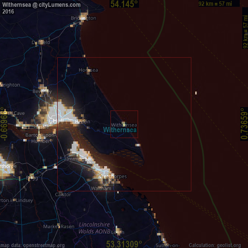
Analysis of Withernsea night lights 2016
Square area 10x10 km:
 0%
0%90-99
0%80-89
0%70-79
0.51%60-69
0%50-59
0.51%40-49
0.51%30-39
0%20-29
0.51%10-19
0%0-9
97.98%Square area 50x50 km:
1.67%90-99
1.59%80-89
0.31%70-79
0.41%60-69
0.53%50-59
0.55%40-49
0.66%30-39
0.75%20-29
3.16%10-19
5.69%0-9
84.67%Clear (daylight) street map image can be seen on geolist.org.
Map coordinates:
54° 8' 42" North, 0° 40' 10.8" West
53° 43' 52.1" North, 0° 1' 55" East
53° 18' 47.1" North, 0° 44' 11.7" East
Some cities around Withernsea sort by population:
• Kingston upon Hull
24.2 km =15 mi,  273°
273°
• Grimsby
19.7 km =12.2 mi,  201°
201°
• Cleethorpes
19.4 km =12.1 mi,  192°
192°
• Immingham
20.9 km =13 mi,  231°
231°
• Hedon
15.1 km =9.4 mi, 273°
• Hornsea
23.9 km =14.9 mi,  326°
326°
• Humberston
22.6 km =14 mi, 189°
• Waltham
25.4 km =15.8 mi, 200°
2633744 (p: 6,159)
Sources (retrieved 2019-11-25):
» Earth at Night: Flat Maps 2012, 2016