Cleethorpes night lights from space
Night Light of Cleethorpes (England) from space (United Kingdom) Src. Average luminocity for 10x10km area is 29.9672% and for 50x50km: 8.1674%.
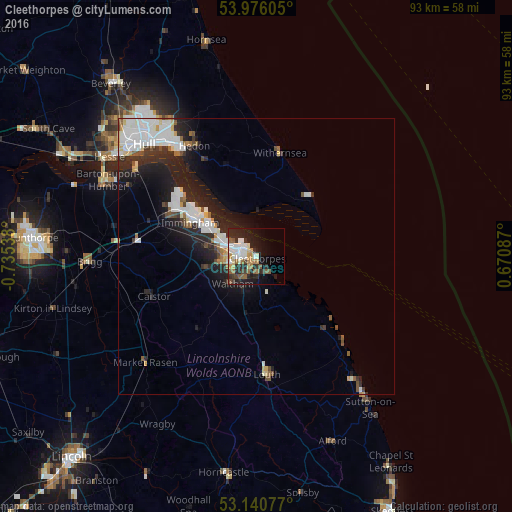
Analysis of Cleethorpes night lights 2016
Square area 10x10 km:
 5.18%
5.18%90-99
6.69%80-89
2.27%70-79
2.78%60-69
4.17%50-59
5.3%40-49
2.53%30-39
3.28%20-29
13.89%10-19
15.53%0-9
38.38%Square area 50x50 km:
2.04%90-99
2.03%80-89
0.49%70-79
0.51%60-69
0.61%50-59
0.76%40-49
0.67%30-39
0.81%20-29
3.2%10-19
5.5%0-9
83.38%Clear (daylight) street map image can be seen on geolist.org.
Map coordinates:
53° 58' 33.8" North, 0° 44' 7.4" West
53° 33' 37.7" North, 0° 1' 56.1" West
53° 8' 26.8" North, 0° 40' 15.1" East
Some cities around Cleethorpes sort by population:
• Kingston upon Hull
28.6 km =17.8 mi,  315°
315°
• Grimsby
2.9 km =1.8 mi,  280°
280°
• Louth
21.6 km =13.4 mi,  175°
175°
• Immingham
13.5 km =8.4 mi,  296°
296°
• Hedon
22.7 km =14.1 mi,  331°
331°
• Humberston
3.4 km =2.1 mi,  171°
171°
• Waltham
6.6 km =4.1 mi,  222°
222°
• Withernsea
19.4 km =12.1 mi,  12°
12°
2652885 (p: 32,017)
Sources (retrieved 2019-11-25):
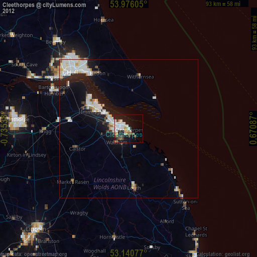
» Earth at Night: Flat Maps 2012, 2016