Weymouth night lights from space
Night Light of Weymouth (England) from space (United Kingdom) Src. Average luminocity for 10x10km area is 20.6965% and for 50x50km: 1.7399%.
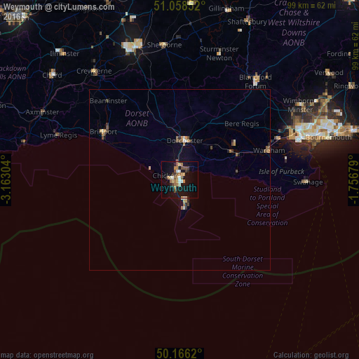

Analysis of Weymouth night lights 2016
Square area 10x10 km:
 1.74%
1.74%90-99
2.67%80-89
1.2%70-79
3.34%60-69
4.81%50-59
2.54%40-49
3.34%30-39
2.27%20-29
2.94%10-19
25.13%0-9
50%Square area 50x50 km:
0.12%90-99
0.18%80-89
0.14%70-79
0.25%60-69
0.39%50-59
0.25%40-49
0.35%30-39
0.21%20-29
0.29%10-19
1.18%0-9
96.64%Clear (daylight) street map image can be seen on geolist.org.
Map coordinates:
51° 3' 30.7" North, 3° 9' 46.9" West
50° 36' 52.1" North, 2° 27' 35.7" West
50° 9' 58.3" North, 1° 45' 24.4" West
Some cities around Weymouth sort by population:
• Poole
35.3 km =21.9 mi,  71°
71°
• Dorchester
11.5 km =7.1 mi,  9°
9°
• Bridport
24.9 km =15.5 mi,  302°
302°
• Portland
5.3 km =3.3 mi,  168°
168°
• Blandford Forum
34.5 km =21.4 mi,  37°
37°
• Swanage
35.1 km =21.8 mi,  90°
90°
• Easton
9.1 km =5.7 mi,  175°
175°
• Wareham
25.9 km =16.1 mi, 71°
2634202 (p: 57,691)
Sources (retrieved 2019-11-25):
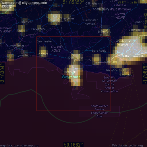
» NASA, Earths city lights 1995
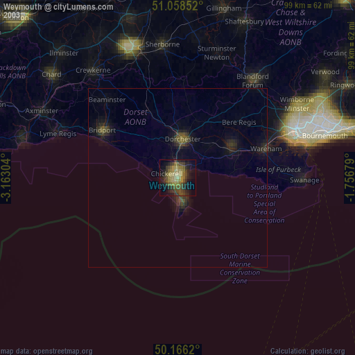
» NASA city lights 2003
» Earth at Night: Flat Maps 2012, 2016