Poole night lights from space
Night Light of Poole (England) from space (United Kingdom) Src. Average luminocity for 10x10km area is 43.2326% and for 50x50km: 6.4006%.
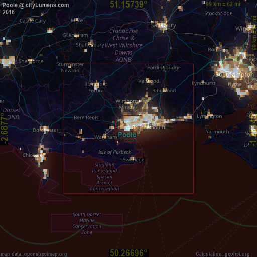
Analysis of Poole night lights 2016
Square area 10x10 km:
 7.22%
7.22%90-99
10.03%80-89
6.42%70-79
6.82%60-69
5.48%50-59
3.74%40-49
4.55%30-39
3.07%20-29
10.29%10-19
26.47%0-9
15.91%Square area 50x50 km:
0.56%90-99
1.19%80-89
0.66%70-79
0.85%60-69
0.96%50-59
0.94%40-49
0.95%30-39
0.97%20-29
2.2%10-19
3.87%0-9
86.84%Clear (daylight) street map image can be seen on geolist.org.
Map coordinates:
51° 9' 26.6" North, 2° 41' 15.7" West
50° 42' 51.4" North, 1° 59' 4.5" West
50° 16' 1.1" North, 1° 16' 53.2" West
Some cities around Poole sort by population:
• Bournemouth
7.4 km =4.6 mi,  84°
84°
• Ferndown
12 km =7.5 mi,  29°
29°
• Wimborne Minster
7.7 km =4.8 mi,  0°
0°
• Canford Heath
4.2 km =2.6 mi,  15°
15°
• Swanage
11.8 km =7.3 mi,  172°
172°
• Broadstone
4.8 km =3 mi,  352°
352°
• Parkstone
3.3 km =2.1 mi,  58°
58°
• Wareham
9.3 km =5.8 mi,  251°
251°
2640101 (p: 150,092)
Sources (retrieved 2019-11-25):
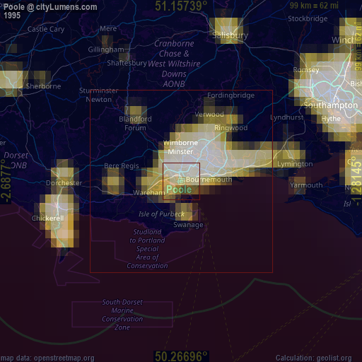
» NASA, Earths city lights 1995
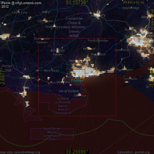
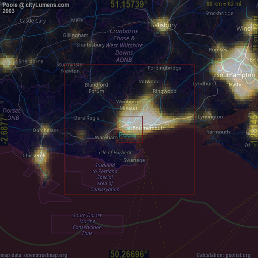
» NASA city lights 2003
» Earth at Night: Flat Maps 2012, 2016