Wardle night lights from space
Night Light of Wardle (England) from space (United Kingdom) Src. Average luminocity for 10x10km area is 33.9217% and for 50x50km: 37.4234%.
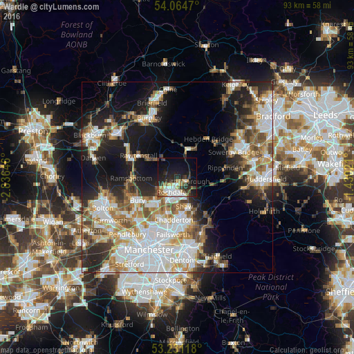
Analysis of Wardle night lights 2016
Square area 10x10 km:
 6.44%
6.44%90-99
6.44%80-89
3.16%70-79
3.91%60-69
4.17%50-59
3.03%40-49
3.79%30-39
4.92%20-29
13.64%10-19
22.98%0-9
27.53%Square area 50x50 km:
10.01%90-99
7.85%80-89
3.57%70-79
3.96%60-69
5.24%50-59
4.91%40-49
4.16%30-39
3.9%20-29
7.45%10-19
14.02%0-9
34.94%Clear (daylight) street map image can be seen on geolist.org.
Map coordinates:
54° 3' 52.9" North, 2° 50' 11.3" West
53° 39' 0" North, 2° 7' 60" West
53° 13' 52.2" North, 1° 25' 48.8" West
Some cities around Wardle sort by population:
• Rochdale
3.9 km =2.4 mi,  201°
201°
• Heywood
8.6 km =5.3 mi,  221°
221°
• Royton
9.5 km =5.9 mi,  175°
175°
• Littleborough
2.6 km =1.6 mi,  104°
104°
• Milnrow
4.5 km =2.8 mi,  162°
162°
• Bacup
7.4 km =4.6 mi,  323°
323°
• Todmorden
7.5 km =4.7 mi,  18°
18°
• Whitworth
3 km =1.9 mi,  283°
283°
2634782 (p: 7,250)
Sources (retrieved 2019-11-25):
» Earth at Night: Flat Maps 2012, 2016