Rochdale night lights from space
Night Light of Rochdale (England) from space (United Kingdom) Src. Average luminocity for 10x10km area is 58.3359% and for 50x50km: 39.3406%.
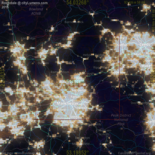
Analysis of Rochdale night lights 2016
Square area 10x10 km:
 12.88%
90-99
13.76%80-89
4.04%70-79
7.32%60-69
10.86%50-59
10.86%40-49
6.31%30-39
6.06%20-29
15.28%10-19
12.37%0-9
0.25%Square area 50x50 km:
10.82%90-99
8.67%80-89
3.68%70-79
3.98%60-69
5.22%50-59
4.98%40-49
4.28%30-39
4.3%20-29
7.56%10-19
13.89%0-9
32.62%Clear (daylight) street map image can be seen on geolist.org.
Map coordinates:
54° 1' 57.6" North, 2° 51' 30" West
53° 37' 3.6" North, 2° 9' 18.7" West
53° 11' 54.7" North, 1° 27' 7.5" West
Some cities around Rochdale sort by population:
• Oldham
8.9 km =5.5 mi,  164°
164°
• Middleton
8.1 km =5 mi,  201°
201°
• Heywood
5.1 km =3.2 mi,  236°
236°
• Royton
6.2 km =3.9 mi, 159°
• Littleborough
4.9 km =3 mi,  53°
53°
• Milnrow
2.9 km =1.8 mi,  104°
104°
• Wardle
3.9 km =2.4 mi,  21°
21°
• Whitworth
4.5 km =2.8 mi,  341°
341°
2639272 (p: 97,550)
Sources (retrieved 2019-11-25):
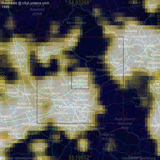
» NASA, Earths city lights 1995
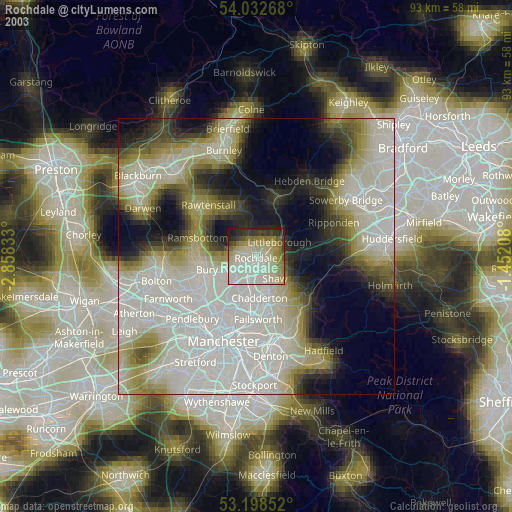
» NASA city lights 2003
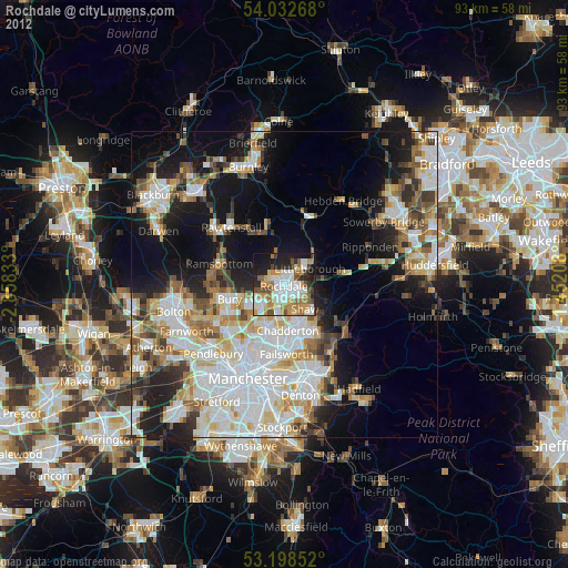
» Earth at Night: Flat Maps 2012, 2016