Swaffham night lights from space
Night Light of Swaffham (England) from space (United Kingdom) Src. Average luminocity for 10x10km area is 1.4087% and for 50x50km: 2.044%.
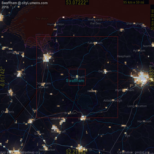
Analysis of Swaffham night lights 2016
Square area 10x10 km:
 0%
0%90-99
0%80-89
0%70-79
0.93%60-69
0.13%50-59
0.26%40-49
0.79%30-39
0%20-29
0%10-19
0.53%0-9
97.35%Square area 50x50 km:
0.23%90-99
0.32%80-89
0.22%70-79
0.27%60-69
0.24%50-59
0.24%40-49
0.28%30-39
0.41%20-29
0.2%10-19
1.38%0-9
96.22%Clear (daylight) street map image can be seen on geolist.org.
Map coordinates:
53° 4' 20" North, 0° 1' 2.7" West
52° 38' 51.7" North, 0° 41' 8.5" East
52° 13' 8.5" North, 1° 23' 19.8" East
Some cities around Swaffham sort by population:
• King's Lynn
22.7 km =14.1 mi,  300°
300°
• Thetford
26.1 km =16.2 mi,  170°
170°
• East Dereham
17.2 km =10.7 mi,  76°
76°
• Downham Market
20.9 km =13 mi,  257°
257°
• Attleborough
26.6 km =16.5 mi,  122°
122°
• Watton
13.4 km =8.3 mi,  132°
132°
• Fakenham
23 km =14.3 mi,  28°
28°
• Littleport
33.2 km =20.6 mi,  230°
230°
2636464 (p: 7,258)
Sources (retrieved 2019-11-25):
» Earth at Night: Flat Maps 2012, 2016