Southport night lights from space
Night Light of Southport (England) from space (United Kingdom) Src. Average luminocity for 10x10km area is 31.2058% and for 50x50km: 23.0306%.
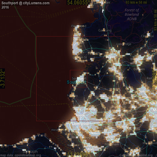
Analysis of Southport night lights 2016
Square area 10x10 km:
 6.44%
6.44%90-99
9.47%80-89
2.02%70-79
1.64%60-69
2.9%50-59
1.14%40-49
2.15%30-39
3.03%20-29
6.44%10-19
39.9%0-9
24.87%Square area 50x50 km:
5.3%90-99
4.95%80-89
1.98%70-79
2.21%60-69
2.61%50-59
2.62%40-49
3.04%30-39
3.41%20-29
6.43%10-19
11.89%0-9
55.57%Clear (daylight) street map image can be seen on geolist.org.
Map coordinates:
54° 3' 38" North, 3° 42' 47.5" West
53° 38' 44.9" North, 3° 0' 36.3" West
53° 13' 37" North, 2° 18' 25" West
Some cities around Southport sort by population:
• Lytham St Annes
10.8 km =6.7 mi,  4°
4°
• Maghull
15.1 km =9.4 mi,  162°
162°
• Ormskirk
12.2 km =7.6 mi,  136°
136°
• Formby
10.5 km =6.5 mi,  202°
202°
• Kirkham
17.7 km =11 mi,  30°
30°
• Burscough
12.5 km =7.8 mi,  116°
116°
• Tarleton
12.5 km =7.8 mi,  72°
72°
• Freckleton
15.4 km =9.6 mi,  38°
38°
2637343 (p: 91,703)
Sources (retrieved 2019-11-25):
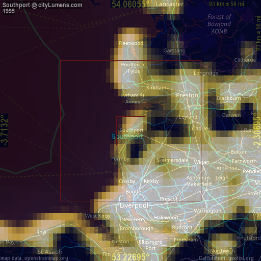
» NASA, Earths city lights 1995
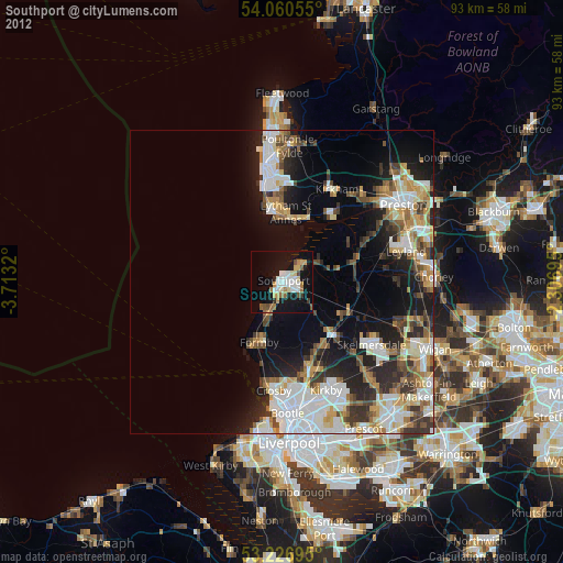
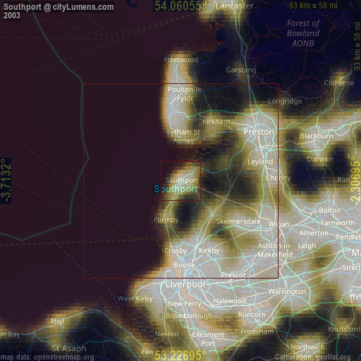
» NASA city lights 2003
» Earth at Night: Flat Maps 2012, 2016