Burscough night lights from space
Night Light of Burscough (England) from space (United Kingdom) Src. Average luminocity for 10x10km area is 21.8535% and for 50x50km: 36.9939%.
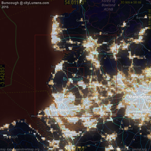
Analysis of Burscough night lights 2016
Square area 10x10 km:
 4.17%
4.17%90-99
4.42%80-89
0.51%70-79
0.51%60-69
4.29%50-59
2.27%40-49
2.02%30-39
2.02%20-29
3.54%10-19
29.67%0-9
46.59%Square area 50x50 km:
8.66%90-99
8.2%80-89
3.34%70-79
3.5%60-69
4.46%50-59
4.28%40-49
5.68%30-39
5.73%20-29
9.34%10-19
15.05%0-9
31.77%Clear (daylight) street map image can be seen on geolist.org.
Map coordinates:
54° 0' 41.9" North, 3° 32' 34.3" West
53° 35' 47" North, 2° 50' 23" West
53° 10' 37.4" North, 2° 8' 11.8" West
Some cities around Burscough sort by population:
• Skelmersdale
6.7 km =4.2 mi,  139°
139°
• Maghull
11.2 km =7 mi,  216°
216°
• Ormskirk
4.3 km =2.7 mi, 220°
• Coppull
12.4 km =7.7 mi,  74°
74°
• Tarleton
9.3 km =5.8 mi,  4°
4°
• Rainford
11 km =6.8 mi,  162°
162°
• Appley Bridge
8.1 km =5 mi,  104°
104°
• Shevington
10 km =6.2 mi,  105°
105°
2654228 (p: 8,799)
Sources (retrieved 2019-11-25):
» Earth at Night: Flat Maps 2012, 2016