Maghull night lights from space
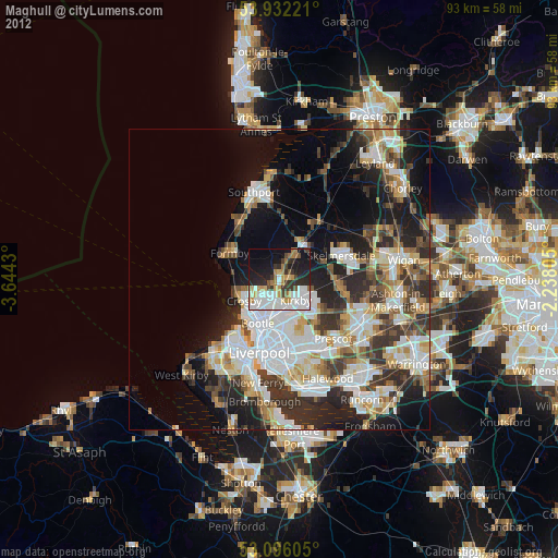
Night Light of Maghull (England) from space (United Kingdom) Src. Average luminocity for 10x10km area is 53.1389% and for 50x50km: 34.2502%.
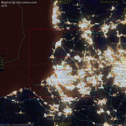
Analysis of Maghull night lights 2016
Square area 10x10 km:
100  10.85%
90-99 13.62%
80-89 5.56%
70-79 6.61%
60-69 5.42%
50-59 5.29%
40-49 5.69%
30-39 9.66%
20-29 18.78%
10-19 17.59%
0-9 0.93%
10.85%90-99
13.62%80-89
5.56%70-79
6.61%60-69
5.42%50-59
5.29%40-49
5.69%30-39
9.66%20-29
18.78%10-19
17.59%0-9
0.93%Square area 50x50 km:
100 8.56%
90-99 7.8%
80-89 3.04%
70-79 3.02%
60-69 3.85%
50-59 3.57%
40-49 5.17%
30-39 6.06%
20-29 8.7%
10-19 12.04%
0-9 38.18%
8.56%90-99
7.8%80-89
3.04%70-79
3.02%60-69
3.85%50-59
3.57%40-49
5.17%30-39
6.06%20-29
8.7%10-19
12.04%0-9
38.18%Clear (daylight) street map image can be seen on geolist.org.
Map coordinates:
53° 55' 56" North, 3° 38' 39.5" West
53° 30' 58.3" North, 2° 56' 28.2" West
53° 5' 45.8" North, 2° 14' 17" West
Some cities around Maghull sort by population:
• Bootle
7.4 km =4.6 mi,  222°
222°
• Crosby
7.4 km =4.6 mi,  234°
234°
• Kirkby
5 km =3.1 mi,  140°
140°
• Ormskirk
6.9 km =4.3 mi,  34°
34°
• Formby
9.7 km =6 mi,  298°
298°
• Litherland
6.4 km =4 mi, 216°
• Burscough
11.2 km =7 mi,  36°
36°
• Rainford
10.2 km =6.3 mi,  98°
98°
2643198 (p: 26,997)
Sources (retrieved 2019-11-25):
» Earth at Night: Flat Maps 2012, 2016