South Hayling night lights from space
Night Light of South Hayling (England) from space (United Kingdom) Src. Average luminocity for 10x10km area is 11.5154% and for 50x50km: 9.7285%.
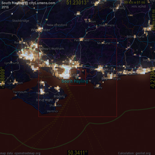
Analysis of South Hayling night lights 2016
Square area 10x10 km:
 0%
0%90-99
0%80-89
0.98%70-79
1.82%60-69
0%50-59
1.68%40-49
2.38%30-39
4.06%20-29
8.82%10-19
17.65%0-9
62.61%Square area 50x50 km:
1.19%90-99
1.53%80-89
0.56%70-79
0.87%60-69
1.12%50-59
1.72%40-49
1.96%30-39
2.24%20-29
2.8%10-19
7.52%0-9
78.49%Clear (daylight) street map image can be seen on geolist.org.
Map coordinates:
51° 13' 48.5" North, 1° 40' 48.3" West
50° 47' 15.8" North, 0° 58' 37.1" West
50° 20' 28" North, 0° 16' 25.8" West
Some cities around South Hayling sort by population:
• Portsmouth
8.1 km =5 mi,  278°
278°
• Gosport
10.7 km =6.6 mi,  274°
274°
• Waterlooville
11 km =6.8 mi,  340°
340°
• Havant
7.7 km =4.8 mi,  355°
355°
• Emsworth
7.2 km =4.5 mi,  22°
22°
• Hayling Island
0.7 km =0.4 mi,  126°
126°
• Cosham
8.9 km =5.5 mi,  317°
317°
• East Wittering
7.5 km =4.7 mi,  105°
105°
2637407 (p: 15,485)
Sources (retrieved 2019-11-25):
» Earth at Night: Flat Maps 2012, 2016