Hayling Island night lights from space
Night Light of Hayling Island (England) from space (United Kingdom) Src. Average luminocity for 10x10km area is 8.2437% and for 50x50km: 9.4875%.
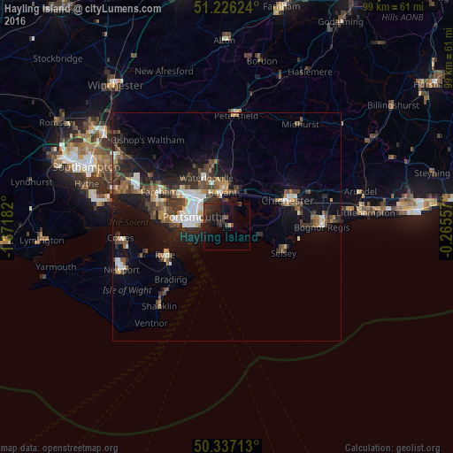
Analysis of Hayling Island night lights 2016
Square area 10x10 km:
 0%
0%90-99
0%80-89
0%70-79
0.56%60-69
0%50-59
1.4%40-49
1.82%30-39
3.64%20-29
6.72%10-19
15.13%0-9
70.73%Square area 50x50 km:
1.16%90-99
1.51%80-89
0.56%70-79
0.85%60-69
1.09%50-59
1.58%40-49
1.9%30-39
2.2%20-29
2.78%10-19
7.35%0-9
79.01%Clear (daylight) street map image can be seen on geolist.org.
Map coordinates:
51° 13' 34.5" North, 1° 40' 18.6" West
50° 47' 1.7" North, 0° 58' 7.3" West
50° 20' 13.7" North, 0° 15' 56.1" West
Some cities around Hayling Island sort by population:
• Portsmouth
8.8 km =5.5 mi,  281°
281°
• Gosport
11.3 km =7 mi, 276°
• Havant
8.2 km =5.1 mi,  351°
351°
• Emsworth
7.5 km =4.7 mi,  17°
17°
• Southsea
8.3 km =5.2 mi, 276°
• South Hayling
0.7 km =0.4 mi,  306°
306°
• Cosham
9.6 km =6 mi,  316°
316°
• East Wittering
6.8 km =4.2 mi,  103°
103°
8299619 (p: 16,887)
Sources (retrieved 2019-11-25):
» Earth at Night: Flat Maps 2012, 2016