Saltburn-by-the-Sea night lights from space
Night Light of Saltburn-by-the-Sea (England) from space (United Kingdom) Src. Average luminocity for 10x10km area is 21.1208% and for 50x50km: 12.5743%.
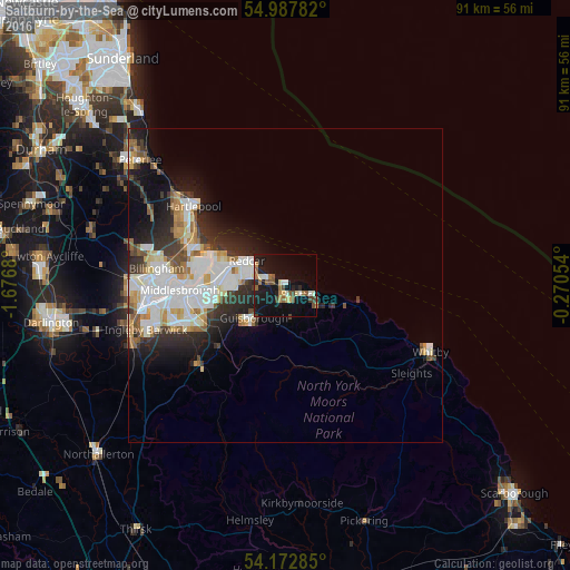
Analysis of Saltburn-by-the-Sea night lights 2016
Square area 10x10 km:
 2.03%
2.03%90-99
3.23%80-89
1.91%70-79
1.91%60-69
2.75%50-59
3.95%40-49
3.59%30-39
1.32%20-29
3.23%10-19
28.47%0-9
47.61%Square area 50x50 km:
3%90-99
3.26%80-89
1.15%70-79
1.15%60-69
1.23%50-59
1.19%40-49
1.09%30-39
1.73%20-29
3.15%10-19
5.61%0-9
77.44%Clear (daylight) street map image can be seen on geolist.org.
Map coordinates:
54° 59' 16.2" North, 1° 40' 36.5" West
54° 34' 56.5" North, 0° 58' 25.2" West
54° 10' 22.3" North, 0° 16' 13.9" West
Some cities around Saltburn-by-the-Sea sort by population:
• Middlesbrough
16.8 km =10.4 mi,  267°
267°
• Hartlepool
19.1 km =11.9 mi,  306°
306°
• Redcar
6.7 km =4.2 mi,  304°
304°
• Guisborough
7.5 km =4.7 mi,  225°
225°
• Ingleby Greenhow
17.1 km =10.6 mi,  210°
210°
• Marske-by-the-Sea
3.1 km =1.9 mi,  288°
288°
• Skelton
2.6 km =1.6 mi,  201°
201°
• Brotton
2.8 km =1.7 mi,  128°
128°
2638650 (p: 5,958)
Sources (retrieved 2019-11-25):
» Earth at Night: Flat Maps 2012, 2016