Brotton night lights from space
Night Light of Brotton (England) from space (United Kingdom) Src. Average luminocity for 10x10km area is 15.4402% and for 50x50km: 11.1996%.
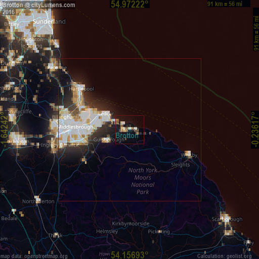
Analysis of Brotton night lights 2016
Square area 10x10 km:
 0.96%
0.96%90-99
2.15%80-89
1.79%70-79
1.67%60-69
1.67%50-59
2.87%40-49
3.71%30-39
0.96%20-29
2.27%10-19
14.71%0-9
67.22%Square area 50x50 km:
2.85%90-99
3.02%80-89
1.01%70-79
0.97%60-69
1.05%50-59
0.8%40-49
0.9%30-39
1.45%20-29
2.83%10-19
4.94%0-9
80.19%Clear (daylight) street map image can be seen on geolist.org.
Map coordinates:
54° 58' 20" North, 1° 38' 32.7" West
54° 33' 59.8" North, 0° 56' 21.4" West
54° 9' 24.9" North, 0° 14' 10.2" West
Some cities around Brotton sort by population:
• Middlesbrough
19.1 km =11.9 mi,  273°
273°
• Hartlepool
21.9 km =13.6 mi,  307°
307°
• Redcar
9.6 km =6 mi, 305°
• Guisborough
8.3 km =5.2 mi,  244°
244°
• Ingleby Greenhow
16.9 km =10.5 mi,  219°
219°
• Marske-by-the-Sea
5.9 km =3.7 mi,  298°
298°
• Skelton
3.2 km =2 mi,  258°
258°
• Saltburn-by-the-Sea
2.8 km =1.7 mi, 308°
2654533 (p: 5,394)
Sources (retrieved 2019-11-25):
» Earth at Night: Flat Maps 2012, 2016