Salford night lights from space
Night Light of Salford (England) from space (United Kingdom) Src. Average luminocity for 10x10km area is 96.5807% and for 50x50km: 42.8779%.
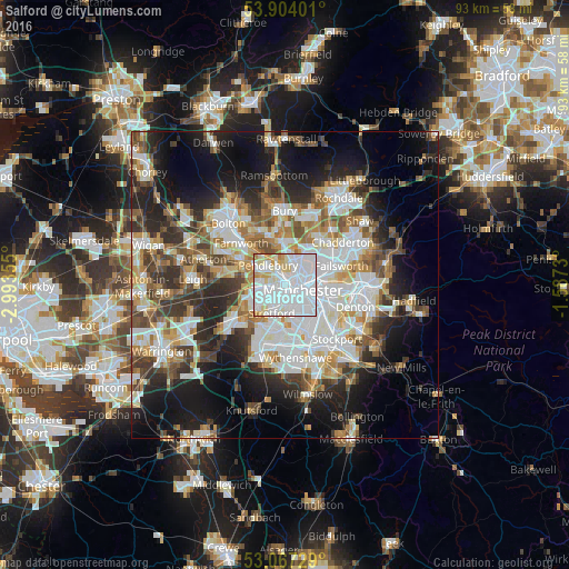
Analysis of Salford night lights 2016
Square area 10x10 km:
 62.7%
62.7%90-99
23.02%80-89
8.47%70-79
5.03%60-69
0.79%50-59
0%40-49
0%30-39
0%20-29
0%10-19
0%0-9
0%Square area 50x50 km:
11.36%90-99
9.33%80-89
4.3%70-79
4.56%60-69
5.18%50-59
4.9%40-49
5.35%30-39
5.78%20-29
9.06%10-19
14.74%0-9
25.44%Clear (daylight) street map image can be seen on geolist.org.
Map coordinates:
53° 54' 14.4" North, 2° 59' 36.8" West
53° 29' 15.8" North, 2° 17' 25.5" West
53° 4' 2.2" North, 1° 35' 14.3" West
Some cities around Salford sort by population:
• Manchester
3.6 km =2.2 mi,  102°
102°
• Stretford
4.5 km =2.8 mi,  202°
202°
• Eccles
2.9 km =1.8 mi,  260°
260°
• Prestwich
5.1 km =3.2 mi,  5°
5°
• Swinton
4.2 km =2.6 mi,  289°
289°
• Cheetham Hill
3.6 km =2.2 mi,  70°
70°
• Crumpsall
4.6 km =2.9 mi,  41°
41°
• Hulme
3.7 km =2.3 mi,  131°
131°
2638671 (p: 72,750)
Sources (retrieved 2019-11-25):
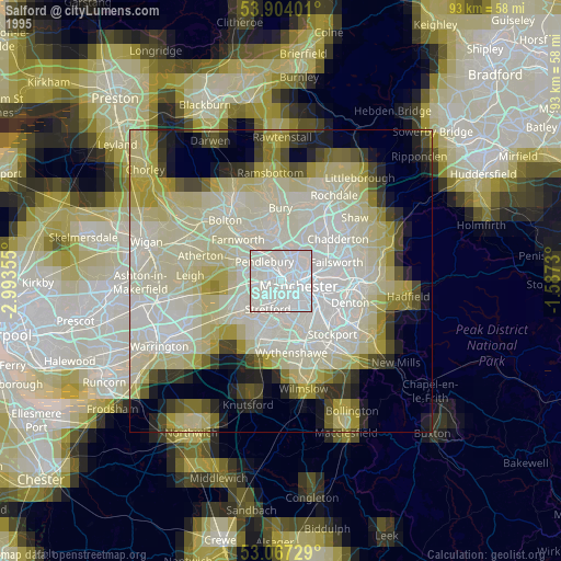
» NASA, Earths city lights 1995
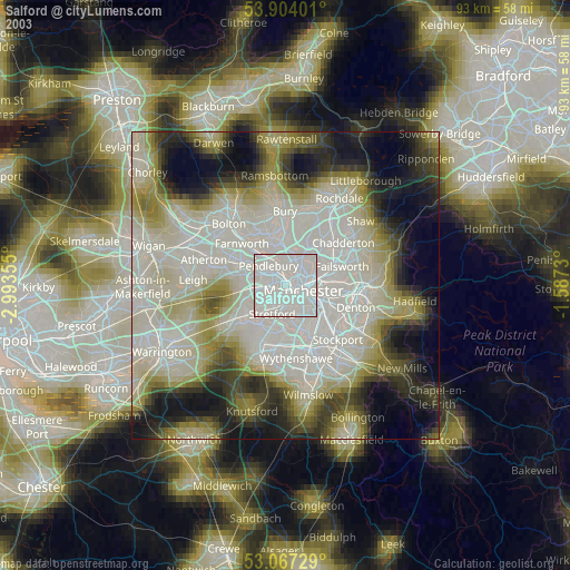
» NASA city lights 2003
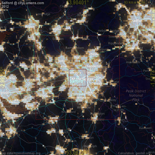
» Earth at Night: Flat Maps 2012, 2016