Oldham night lights from space
Night Light of Oldham (England) from space (United Kingdom) Src. Average luminocity for 10x10km area is 77.1019% and for 50x50km: 39.3251%.
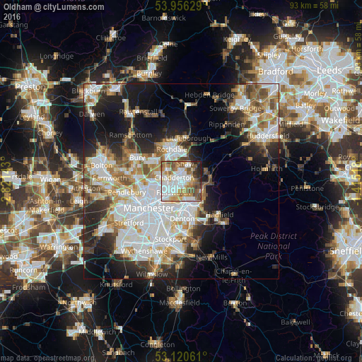
Analysis of Oldham night lights 2016
Square area 10x10 km:
 26.32%
90-99
18.25%80-89
7.67%70-79
10.19%60-69
11.51%50-59
11.24%40-49
7.41%30-39
3.04%20-29
3.44%10-19
0.93%0-9
0%Square area 50x50 km:
11.21%90-99
8.9%80-89
3.83%70-79
4.04%60-69
5.05%50-59
4.66%40-49
3.93%30-39
4.02%20-29
7.68%10-19
12.36%0-9
34.33%Clear (daylight) street map image can be seen on geolist.org.
Map coordinates:
53° 57' 22.6" North, 2° 49' 17.1" West
53° 32' 25.8" North, 2° 7' 5.9" West
53° 7' 14.2" North, 1° 24' 54.6" West
Some cities around Oldham sort by population:
• Middleton
5.5 km =3.4 mi,  281°
281°
• Ashton-under-Lyne
5.9 km =3.7 mi,  167°
167°
• Droylsden
7 km =4.3 mi,  194°
194°
• Royton
2.7 km =1.7 mi,  353°
353°
• Stalybridge
7.4 km =4.6 mi,  148°
148°
• Failsworth
5.1 km =3.2 mi,  218°
218°
• Blackley
6.8 km =4.2 mi,  248°
248°
• Mossley
6.2 km =3.9 mi,  117°
117°
2641022 (p: 104,782)
Sources (retrieved 2019-11-25):
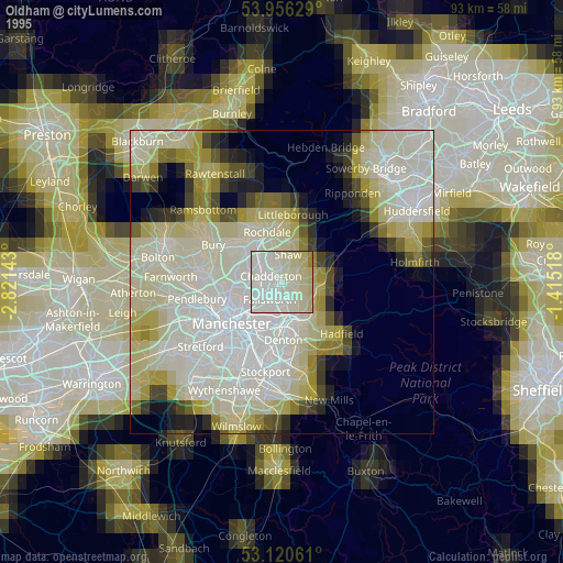
» NASA, Earths city lights 1995
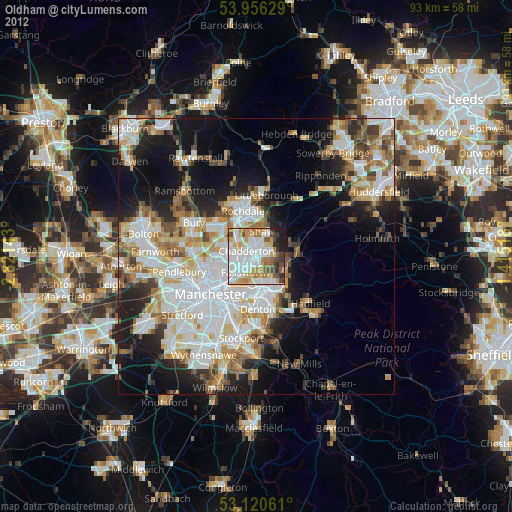
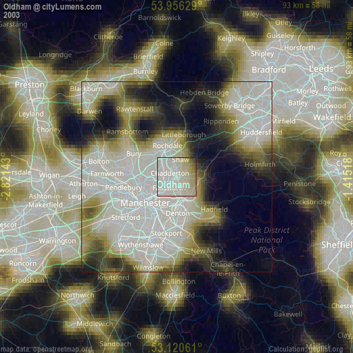
» NASA city lights 2003
» Earth at Night: Flat Maps 2012, 2016