Risca night lights from space
Night Light of Risca (Wales) from space (United Kingdom) Src. Average luminocity for 10x10km area is 29.4345% and for 50x50km: 19.2488%.
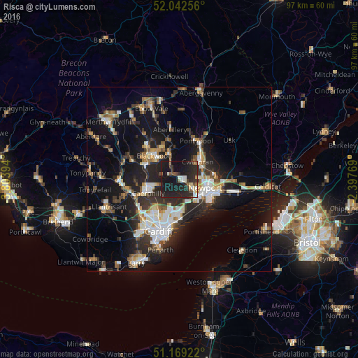
Analysis of Risca night lights 2016
Square area 10x10 km:
100  2.14%
2.14%
90-99 5.35%
80-89 1.6%
70-79 1.87%
60-69 3.07%
50-59 2.67%
40-49 3.61%
30-39 4.55%
20-29 25.4%
10-19 47.06%
0-9 2.67%
2.14%90-99
5.35%80-89
1.6%70-79
1.87%60-69
3.07%50-59
2.67%40-49
3.61%30-39
4.55%20-29
25.4%10-19
47.06%0-9
2.67%Square area 50x50 km:
100 2.96%
90-99 3.66%
80-89 1.44%
70-79 2.02%
60-69 2.02%
50-59 2.27%
40-49 2.51%
30-39 3.05%
20-29 7.03%
10-19 15.59%
0-9 57.44%
2.96%90-99
3.66%80-89
1.44%70-79
2.02%60-69
2.02%50-59
2.27%40-49
2.51%30-39
3.05%20-29
7.03%10-19
15.59%0-9
57.44%Clear (daylight) street map image can be seen on geolist.org.
Map coordinates:
52° 2' 33.2" North, 3° 48' 14.2" West
51° 36' 28.8" North, 3° 6' 2.9" West
51° 10' 9.2" North, 2° 23' 51.7" West
Some cities around Risca sort by population:
• Newport
7.4 km =4.6 mi,  107°
107°
• Cwmbran
7.5 km =4.7 mi,  46°
46°
• Caerphilly
8.9 km =5.5 mi,  245°
245°
• Blackwood
9.9 km =6.2 mi,  312°
312°
• Abercarn
5 km =3.1 mi,  331°
331°
• Bedwas
7 km =4.3 mi,  255°
255°
• Newbridge
6.9 km =4.3 mi,  341°
341°
• Crumlin
8.1 km =5 mi, 342°
2639317 (p: 20,443)
Sources (retrieved 2019-11-25):
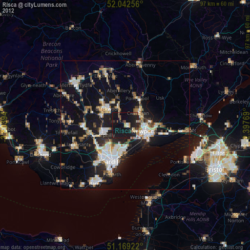
» Earth at Night: Flat Maps 2012, 2016