Preesall night lights from space
Night Light of Preesall (England) from space (United Kingdom) Src. Average luminocity for 10x10km area is 19.1323% and for 50x50km: 11.3845%.
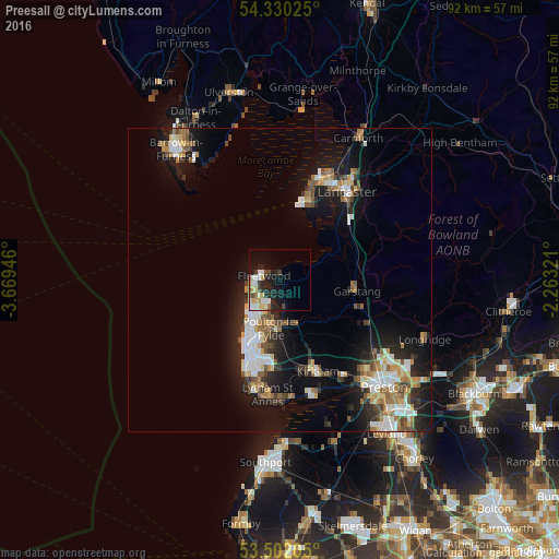
Analysis of Preesall night lights 2016
Square area 10x10 km:
 3.04%
3.04%90-99
4.37%80-89
2.25%70-79
3.31%60-69
0.79%50-59
0.79%40-49
2.51%30-39
1.98%20-29
6.61%10-19
14.29%0-9
60.05%Square area 50x50 km:
1.79%90-99
2.15%80-89
0.99%70-79
1.33%60-69
1.44%50-59
1.46%40-49
1.44%30-39
1.2%20-29
3.19%10-19
9.09%0-9
75.92%Clear (daylight) street map image can be seen on geolist.org.
Map coordinates:
54° 19' 48.9" North, 3° 40' 10.1" West
53° 55' 5.5" North, 2° 57' 58.8" West
53° 30' 7.4" North, 2° 15' 47.6" West
Some cities around Preesall sort by population:
• Blackpool
12.6 km =7.8 mi,  205°
205°
• Fylde
10 km =6.2 mi,  160°
160°
• Thornton-Cleveleys
6.1 km =3.8 mi,  216°
216°
• Fleetwood
3 km =1.9 mi,  285°
285°
• Poulton-le-Fylde
9.5 km =5.9 mi,  186°
186°
• Heysham
14.7 km =9.1 mi,  18°
18°
• Cleveleys
6.6 km =4.1 mi,  226°
226°
• Garstang
12.7 km =7.9 mi,  98°
98°
2639934 (p: 5,367)
Sources (retrieved 2019-11-25):
» Earth at Night: Flat Maps 2012, 2016