Fleetwood night lights from space
Night Light of Fleetwood (England) from space (United Kingdom) Src. Average luminocity for 10x10km area is 19.3333% and for 50x50km: 10.847%.

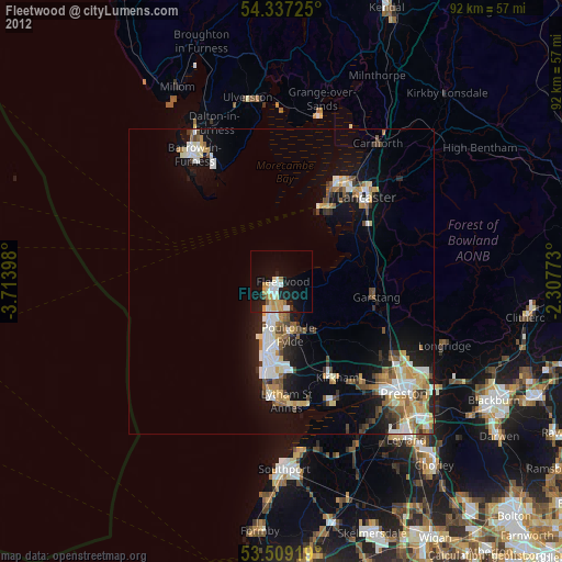
Analysis of Fleetwood night lights 2016
Square area 10x10 km:
 2.12%
2.12%90-99
3.7%80-89
1.32%70-79
3.97%60-69
0.53%50-59
1.06%40-49
2.51%30-39
2.78%20-29
8.07%10-19
21.03%0-9
52.91%Square area 50x50 km:
1.72%90-99
2.11%80-89
0.97%70-79
1.26%60-69
1.35%50-59
1.43%40-49
1.4%30-39
1.17%20-29
2.84%10-19
8.17%0-9
77.6%Clear (daylight) street map image can be seen on geolist.org.
Map coordinates:
54° 20' 14.1" North, 3° 42' 50.3" West
53° 55' 31" North, 3° 0' 39.1" West
53° 30' 33.1" North, 2° 18' 27.8" West
Some cities around Fleetwood sort by population:
• Blackpool
12.3 km =7.6 mi,  191°
191°
• Fylde
11.9 km =7.4 mi,  148°
148°
• Thornton-Cleveleys
5.8 km =3.6 mi, 187°
• Poulton-le-Fylde
10.4 km =6.5 mi,  169°
169°
• Heysham
15.2 km =9.4 mi,  30°
30°
• Cleveleys
5.6 km =3.5 mi,  199°
199°
• Garstang
15.7 km =9.8 mi,  99°
99°
• Preesall
3 km =1.9 mi,  105°
105°
2649312 (p: 25,359)
Sources (retrieved 2019-11-25):
» Earth at Night: Flat Maps 2012, 2016