Blackpool night lights from space
Night Light of Blackpool (England) from space (United Kingdom) Src. Average luminocity for 10x10km area is 50.041% and for 50x50km: 10.4098%.
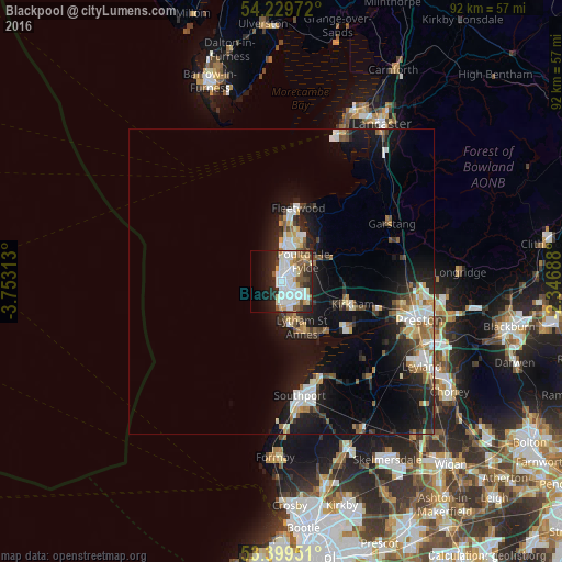
Analysis of Blackpool night lights 2016
Square area 10x10 km:
 15.74%
90-99
14.42%80-89
4.1%70-79
4.5%60-69
1.46%50-59
7.01%40-49
4.5%30-39
3.84%20-29
12.83%10-19
11.51%0-9
20.11%Square area 50x50 km:
1.7%90-99
2.19%80-89
0.84%70-79
0.89%60-69
1.27%50-59
1.18%40-49
1.13%30-39
1.17%20-29
3.14%10-19
9.03%0-9
77.46%Clear (daylight) street map image can be seen on geolist.org.
Map coordinates:
54° 13' 47" North, 3° 45' 11.3" West
53° 49' 0" North, 3° 3' 0" West
53° 23' 58.2" North, 2° 20' 48.8" West
Some cities around Blackpool sort by population:
• Fylde
8.9 km =5.5 mi,  78°
78°
• Lytham St Annes
8.9 km =5.5 mi,  157°
157°
• Thornton-Cleveleys
6.6 km =4.1 mi,  15°
15°
• Fleetwood
12.3 km =7.6 mi,  11°
11°
• Poulton-le-Fylde
4.8 km =3 mi,  67°
67°
• Cleveleys
6.8 km =4.2 mi, 5°
• Kirkham
12.3 km =7.6 mi,  108°
108°
• Preesall
12.6 km =7.8 mi,  25°
25°
2655459 (p: 239,409)
Sources (retrieved 2019-11-25):
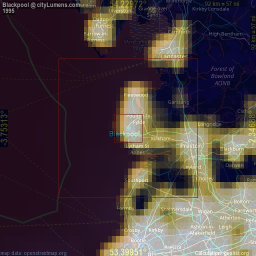
» NASA, Earths city lights 1995
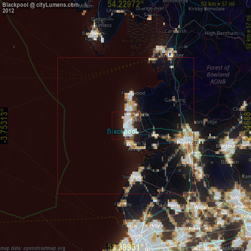
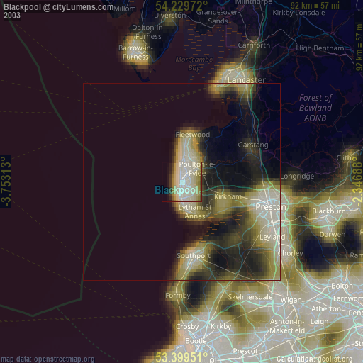
» NASA city lights 2003
» Earth at Night: Flat Maps 2012, 2016