Bournemouth night lights from space
Night Light of Bournemouth (England) from space (United Kingdom) Src. Average luminocity for 10x10km area is 49.1257% and for 50x50km: 6.4682%.
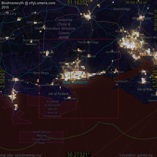

Analysis of Bournemouth night lights 2016
Square area 10x10 km:
 6.15%
6.15%90-99
15.91%80-89
6.82%70-79
6.68%60-69
8.56%50-59
3.61%40-49
3.74%30-39
2.67%20-29
14.84%10-19
20.45%0-9
10.56%Square area 50x50 km:
0.56%90-99
1.19%80-89
0.63%70-79
0.81%60-69
1.04%50-59
0.97%40-49
0.93%30-39
0.99%20-29
2.25%10-19
3.94%0-9
86.68%Clear (daylight) street map image can be seen on geolist.org.
Map coordinates:
51° 9' 48.7" North, 2° 34' 57.5" West
50° 43' 13.7" North, 1° 52' 46.2" West
50° 16' 23.6" North, 1° 10' 35" West
Some cities around Bournemouth sort by population:
• Poole
7.4 km =4.6 mi,  264°
264°
• Christchurch
7.1 km =4.4 mi,  76°
76°
• Ferndown
9.8 km =6.1 mi,  351°
351°
• Wimborne Minster
10.1 km =6.3 mi,  313°
313°
• Canford Heath
7.1 km =4.4 mi,  298°
298°
• Broadstone
9 km =5.6 mi, 296°
• Parkstone
4.7 km =2.9 mi,  282°
282°
• St Leonards
12.5 km =7.8 mi,  11°
11°
2655095 (p: 163,600)
Sources (retrieved 2019-11-25):
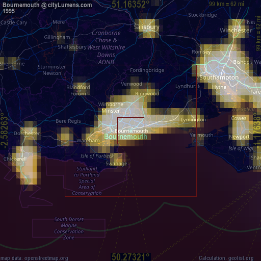
» NASA, Earths city lights 1995
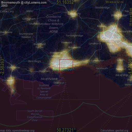
» NASA city lights 2003
» Earth at Night: Flat Maps 2012, 2016