Ferndown night lights from space
Night Light of Ferndown (England) from space (United Kingdom) Src. Average luminocity for 10x10km area is 26.7017% and for 50x50km: 6.6089%.
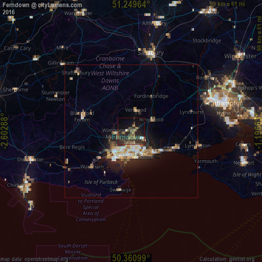
Analysis of Ferndown night lights 2016
Square area 10x10 km:
 0.7%
0.7%90-99
1.54%80-89
0.56%70-79
4.06%60-69
3.64%50-59
7.84%40-49
4.9%30-39
11.2%20-29
18.07%10-19
19.47%0-9
28.01%Square area 50x50 km:
0.56%90-99
1.21%80-89
0.66%70-79
0.87%60-69
1.04%50-59
0.98%40-49
0.94%30-39
1.09%20-29
2.25%10-19
3.9%0-9
86.51%Clear (daylight) street map image can be seen on geolist.org.
Map coordinates:
51° 14' 58.7" North, 2° 36' 10.4" West
50° 48' 26.7" North, 1° 53' 59.1" West
50° 21' 39.6" North, 1° 11' 47.9" West
Some cities around Ferndown sort by population:
• Bournemouth
9.8 km =6.1 mi,  171°
171°
• Wimborne Minster
6.5 km =4 mi,  245°
245°
• Canford Heath
7.9 km =4.9 mi,  217°
217°
• Ringwood
8.9 km =5.5 mi,  61°
61°
• Verwood
7.9 km =4.9 mi,  15°
15°
• Broadstone
8.7 km =5.4 mi,  229°
229°
• Parkstone
9.2 km =5.7 mi,  200°
200°
• St Leonards
4.7 km =2.9 mi, 56°
6691927 (p: 17,650)
Sources (retrieved 2019-11-25):
» Earth at Night: Flat Maps 2012, 2016