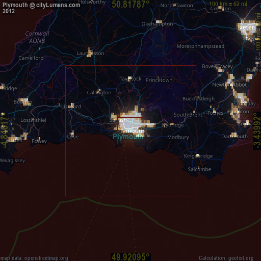
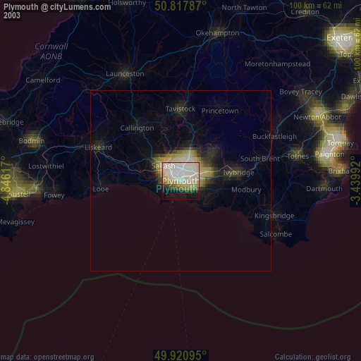
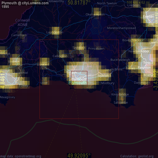
Plymouth night lights from space
Night Light of Plymouth (England) from space (United Kingdom) Src. Average luminocity for 10x10km area is 55.0966% and for 50x50km: 4.3339%.
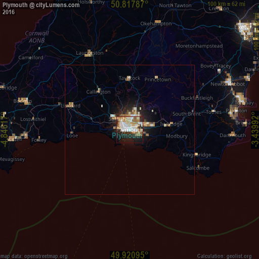
Analysis of Plymouth night lights 2016
Square area 10x10 km:
 11.76%
90-99
14.85%80-89
7.84%70-79
6.72%60-69
8.26%50-59
5.88%40-49
2.38%30-39
3.64%20-29
14.99%10-19
20.03%0-9
3.64%Square area 50x50 km:
0.56%90-99
0.91%80-89
0.57%70-79
0.53%60-69
0.58%50-59
0.58%40-49
0.41%30-39
0.37%20-29
1.24%10-19
2.91%0-9
91.35%Clear (daylight) street map image can be seen on geolist.org.
Map coordinates:
50° 49' 4.3" North, 4° 50' 46.2" West
50° 22' 17.5" North, 4° 8' 35" West
49° 55' 15.4" North, 3° 26' 23.7" West
Some cities around Plymouth sort by population:
• Plymstock
3.9 km =2.4 mi,  108°
108°
• Saltash
7.2 km =4.5 mi,  306°
306°
• Tavistock
19.8 km =12.3 mi,  359°
359°
• Ivybridge
16 km =9.9 mi,  82°
82°
• Plympton
6.2 km =3.9 mi,  70°
70°
• Torpoint
3.8 km =2.4 mi,  275°
275°
• Callington
18.8 km =11.7 mi,  320°
320°
• Looe
22.1 km =13.7 mi,  266°
266°
2640194 (p: 260,203)
Sources (retrieved 2019-11-25):
» NASA, Earths city lights 1995
» NASA city lights 2003
» Earth at Night: Flat Maps 2012, 2016