Peckham night lights from space
Night Light of Peckham (England) from space (United Kingdom) Src. Average luminocity for 10x10km area is 99.881% and for 50x50km: 68.1354%.
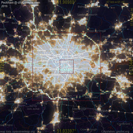
Analysis of Peckham night lights 2016
Square area 10x10 km:
 92.25%
90-99
7.75%80-89
0%70-79
0%60-69
0%50-59
0%40-49
0%30-39
0%20-29
0%10-19
0%0-9
0%Square area 50x50 km:
28.46%90-99
16.82%80-89
6.5%70-79
5.36%60-69
6.25%50-59
6.18%40-49
4.93%30-39
4.85%20-29
5.64%10-19
5.66%0-9
9.34%Clear (daylight) street map image can be seen on geolist.org.
Map coordinates:
51° 54' 35.6" North, 0° 46' 22.2" West
51° 28' 26.5" North, 0° 4' 10.9" West
51° 2' 2.3" North, 0° 38' 0.4" East
Some cities around Peckham sort by population:
• London
5.5 km =3.4 mi,  314°
314°
• City of Westminster
5.3 km =3.3 mi,  299°
299°
• Canary Wharf
4.8 km =3 mi,  44°
44°
• Brixton
2.7 km =1.7 mi,  250°
250°
• Blackheath
5.5 km =3.4 mi,  100°
100°
• Brixton Hill
4.4 km =2.7 mi,  236°
236°
• City of London
4.6 km =2.9 mi,  340°
340°
• Lambeth
3.8 km =2.4 mi, 310°
8224580 (p: 71,552)
Sources (retrieved 2019-11-25):
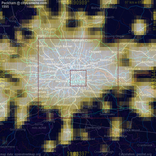
» NASA, Earths city lights 1995
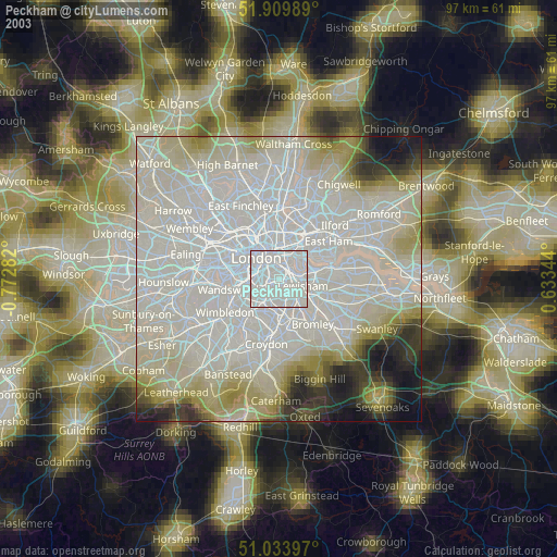
» NASA city lights 2003
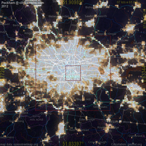
» Earth at Night: Flat Maps 2012, 2016