Canary Wharf night lights from space
Night Light of Canary Wharf (England) from space (United Kingdom) Src. Average luminocity for 10x10km area is 99.9385% and for 50x50km: 66.7594%.
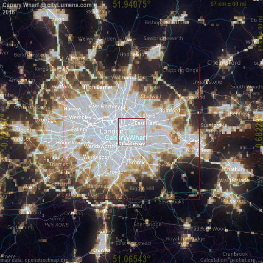

Analysis of Canary Wharf night lights 2016
Square area 10x10 km:
 94.92%
90-99
5.08%80-89
0%70-79
0%60-69
0%50-59
0%40-49
0%30-39
0%20-29
0%10-19
0%0-9
0%Square area 50x50 km:
27.75%90-99
16.05%80-89
6.16%70-79
5.14%60-69
6.33%50-59
5.76%40-49
5.1%30-39
5.57%20-29
6.99%10-19
6.34%0-9
8.81%Clear (daylight) street map image can be seen on geolist.org.
Map coordinates:
51° 56' 26.7" North, 0° 43' 26.3" West
51° 30' 18.7" North, 0° 1' 15.1" West
51° 3' 55.5" North, 0° 40' 56.2" East
Some cities around Canary Wharf sort by population:
• London
7.3 km =4.5 mi,  272°
272°
• Islington
6.7 km =4.2 mi,  301°
301°
• Peckham
4.8 km =3 mi,  224°
224°
• Brixton
7.4 km =4.6 mi,  233°
233°
• Blackheath
4.9 km =3 mi,  156°
156°
• Bethnal Green
3.7 km =2.3 mi,  311°
311°
• City of London
5 km =3.1 mi,  279°
279°
• Lambeth
6.4 km =4 mi,  261°
261°
6692280 (p: 73,390)
Sources (retrieved 2019-11-25):
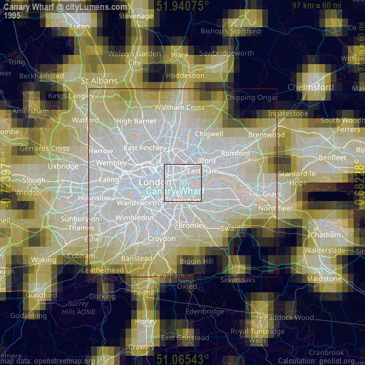
» NASA, Earths city lights 1995
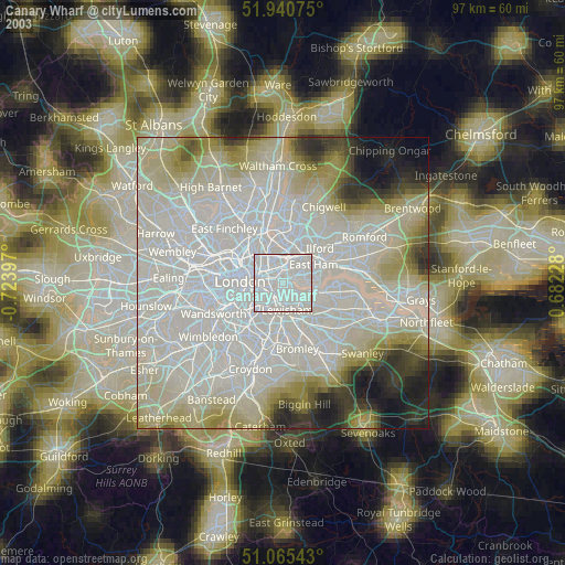
» NASA city lights 2003
» Earth at Night: Flat Maps 2012, 2016