Oxted night lights from space
Night Light of Oxted (England) from space (United Kingdom) Src. Average luminocity for 10x10km area is 9.1625% and for 50x50km: 34.5629%.
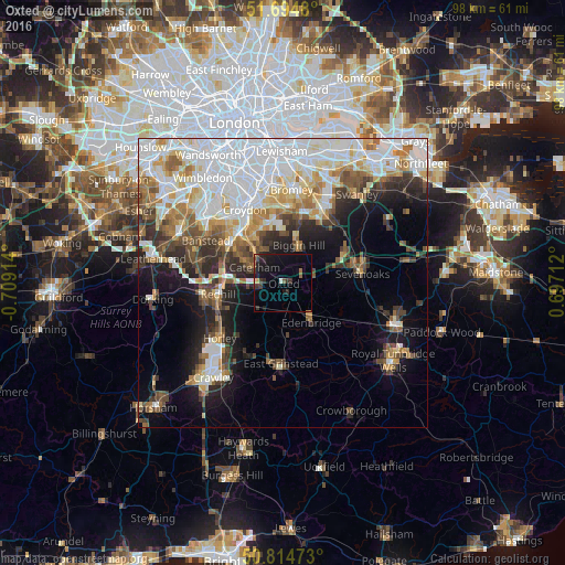
Analysis of Oxted night lights 2016
Square area 10x10 km:
 0.42%
0.42%90-99
0.14%80-89
0.28%70-79
0.56%60-69
0.98%50-59
1.26%40-49
0.98%30-39
3.78%20-29
2.66%10-19
14.15%0-9
74.79%Square area 50x50 km:
10.68%90-99
7.6%80-89
3.38%70-79
3.49%60-69
4.12%50-59
3.52%40-49
3.77%30-39
3.73%20-29
5.08%10-19
9.06%0-9
45.57%Clear (daylight) street map image can be seen on geolist.org.
Map coordinates:
51° 41' 41.3" North, 0° 42' 32.9" West
51° 15' 24.7" North, 0° 0' 21.6" West
50° 48' 53" North, 0° 41' 49.6" East
Some cities around Oxted sort by population:
• Purley
11.5 km =7.1 mi,  320°
320°
• Redhill
11.6 km =7.2 mi,  260°
260°
• Coulsdon
11.7 km =7.3 mi,  306°
306°
• Caterham
5.8 km =3.6 mi,  299°
299°
• West Wickham
12.2 km =7.6 mi,  356°
356°
• Biggin Hill
6.9 km =4.3 mi,  24°
24°
• Edenbridge
8.9 km =5.5 mi,  144°
144°
• Warlingham
6.9 km =4.3 mi,  328°
328°
2640717 (p: 13,452)
Sources (retrieved 2019-11-25):
» Earth at Night: Flat Maps 2012, 2016