North Walsham night lights from space
Night Light of North Walsham (England) from space (United Kingdom) Src. Average luminocity for 10x10km area is 4.3801% and for 50x50km: 4.0117%.
Analysis of North Walsham night lights 2016
Square area 10x10 km:
 0.38%
0.38%90-99
0.38%80-89
1.39%70-79
0.88%60-69
0.38%50-59
0.13%40-49
1.52%30-39
0%20-29
0%10-19
0%0-9
94.95%Square area 50x50 km:
0.73%90-99
0.8%80-89
0.44%70-79
0.35%60-69
0.3%50-59
0.59%40-49
0.65%30-39
0.44%20-29
1.11%10-19
2.61%0-9
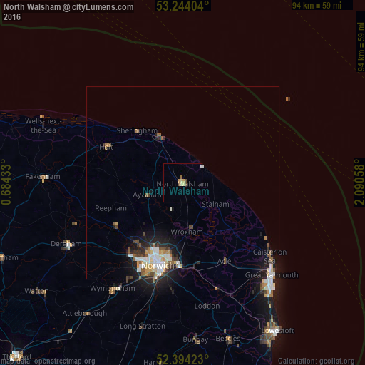
91.98%Clear (daylight) street map image can be seen on geolist.org.
Map coordinates:
53° 14' 38.5" North, 0° 41' 3.6" East
52° 49' 16.4" North, 1° 23' 14.9" East
52° 23' 39.2" North, 2° 5' 26.1" East
Some cities around North Walsham sort by population:
• Norwich
22.3 km =13.9 mi,  195°
195°
• Bowthorpe
23.2 km =14.4 mi,  209°
209°
• Cromer
13.6 km =8.5 mi,  334°
334°
• Thorpe Hamlet
22.1 km =13.7 mi,  193°
193°
• Sheringham
17.9 km =11.1 mi,  318°
318°
• Aylsham
9.6 km =6 mi,  253°
253°
• Brundall
22.1 km =13.7 mi,  171°
171°
• Hemsby
24.7 km =15.3 mi,  123°
123°
2641233 (p: 12,463)
Sources (retrieved 2019-11-25):
» Earth at Night: Flat Maps 2012, 2016