Bowthorpe night lights from space
Night Light of Bowthorpe (England) from space (United Kingdom) Src. Average luminocity for 10x10km area is 43.7963% and for 50x50km: 4.1778%.
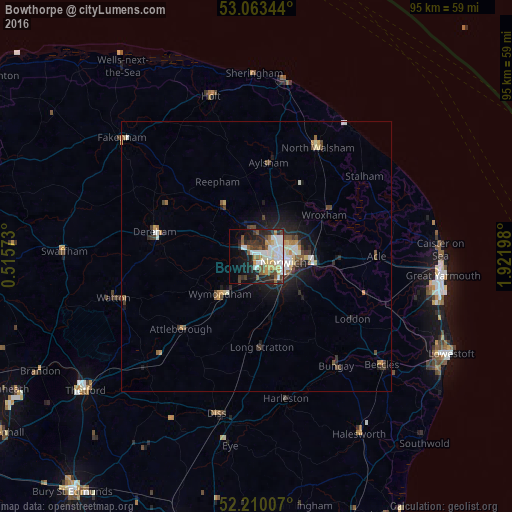
Analysis of Bowthorpe night lights 2016
Square area 10x10 km:
 11.38%
90-99
10.45%80-89
4.37%70-79
4.76%60-69
2.12%50-59
6.22%40-49
5.16%30-39
5.56%20-29
12.57%10-19
15.21%0-9
22.22%Square area 50x50 km:
0.7%90-99
0.76%80-89
0.4%70-79
0.43%60-69
0.36%50-59
0.53%40-49
0.74%30-39
0.57%20-29
1.21%10-19
2.8%0-9
91.5%Clear (daylight) street map image can be seen on geolist.org.
Map coordinates:
53° 3' 48.4" North, 0° 30' 56.6" East
52° 38' 19.8" North, 1° 13' 7.9" East
52° 12' 36.3" North, 1° 55' 19.1" East
Some cities around Bowthorpe sort by population:
• Norwich
5.5 km =3.4 mi,  102°
102°
• East Dereham
19.9 km =12.4 mi,  284°
284°
• Attleborough
19.2 km =11.9 mi,  225°
225°
• Thorpe Hamlet
6.4 km =4 mi, 101°
• Aylsham
17.7 km =11 mi,  7°
7°
• Brundall
14.7 km =9.1 mi, 96°
• Hethersett
5.5 km =3.4 mi,  213°
213°
• Poringland
11.9 km =7.4 mi,  131°
131°
6620355 (p: 20,000)
Sources (retrieved 2019-11-25):
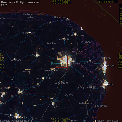
» Earth at Night: Flat Maps 2012, 2016