North Berwick night lights from space
Night Light of North Berwick (Scotland) from space (United Kingdom) Src. Average luminocity for 10x10km area is 1.0861% and for 50x50km: 3.8172%.
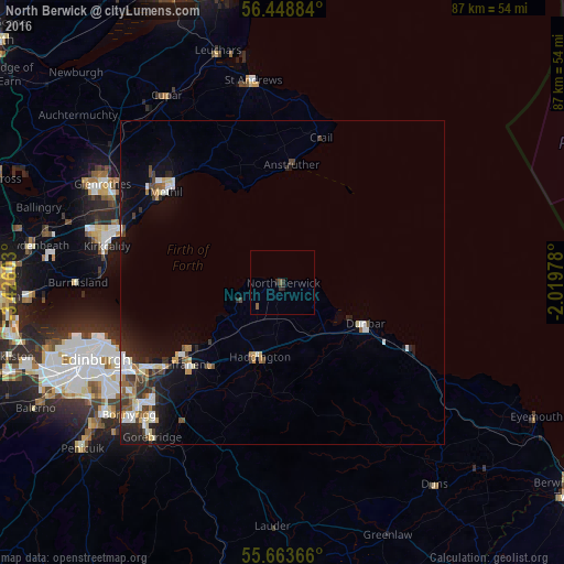
Analysis of North Berwick night lights 2016
Square area 10x10 km:
 0%
0%90-99
0%80-89
0%70-79
0%60-69
0%50-59
0.84%40-49
0.12%30-39
0.12%20-29
1.79%10-19
0%0-9
97.13%Square area 50x50 km:
0.64%90-99
0.65%80-89
0.34%70-79
0.37%60-69
0.38%50-59
0.38%40-49
0.56%30-39
0.64%20-29
1.07%10-19
2.46%0-9
92.5%Clear (daylight) street map image can be seen on geolist.org.
Map coordinates:
56° 26' 55.8" North, 3° 25' 33.7" West
56° 3' 29.7" North, 2° 43' 22.4" West
55° 39' 49.2" North, 2° 1' 11.2" West
Some cities around North Berwick sort by population:
• Musselburgh
24.1 km =15 mi,  237°
237°
• Tranent
19.2 km =11.9 mi,  228°
228°
• Methil
23.3 km =14.5 mi,  307°
307°
• Prestonpans
19.4 km =12.1 mi, 235°
• Haddington
12 km =7.5 mi,  198°
198°
• Leven
23.3 km =14.5 mi, 312°
• Dunbar
14.5 km =9 mi,  116°
116°
• Cockenzie
18.1 km =11.2 mi, 236°
2641419 (p: 6,650)
Sources (retrieved 2019-11-25):
» Earth at Night: Flat Maps 2012, 2016