Cockenzie night lights from space
Night Light of Cockenzie (Scotland) from space (United Kingdom) Src. Average luminocity for 10x10km area is 15.198% and for 50x50km: 11.6099%.
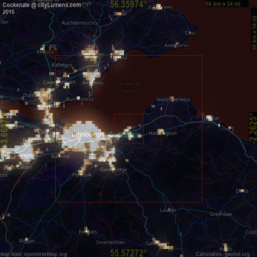
Analysis of Cockenzie night lights 2016
Square area 10x10 km:
 1.38%
1.38%90-99
1.5%80-89
2.38%70-79
2.88%60-69
1.63%50-59
1%40-49
2.26%30-39
2.88%20-29
2.88%10-19
12.78%0-9
68.42%Square area 50x50 km:
2.67%90-99
2.8%80-89
1%70-79
0.81%60-69
0.97%50-59
0.9%40-49
1.11%30-39
1.61%20-29
3.93%10-19
6.54%0-9
77.67%Clear (daylight) street map image can be seen on geolist.org.
Map coordinates:
56° 21' 35.1" North, 3° 40' 7.5" West
55° 58' 5.6" North, 2° 57' 56.2" West
55° 34' 21.8" North, 2° 15' 45" West
Some cities around Cockenzie sort by population:
• Musselburgh
6 km =3.7 mi,  240°
240°
• Bonnyrigg
13.7 km =8.5 mi,  219°
219°
• Mayfield
11.7 km =7.3 mi,  203°
203°
• Dalkeith
10.5 km =6.5 mi, 217°
• Tranent
2.7 km =1.7 mi,  164°
164°
• Prestonpans
1.3 km =0.8 mi, 223°
• Haddington
11.4 km =7.1 mi,  96°
96°
• Gorebridge
14.5 km =9 mi, 200°
2652681 (p: 5,660)
Sources (retrieved 2019-11-25):
» Earth at Night: Flat Maps 2012, 2016