Musselburgh night lights from space
Night Light of Musselburgh (Scotland) from space (United Kingdom) Src. Average luminocity for 10x10km area is 36.609% and for 50x50km: 13.5824%.
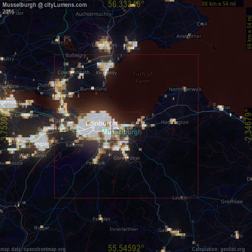
Analysis of Musselburgh night lights 2016
Square area 10x10 km:
 6.02%
6.02%90-99
8.4%80-89
2.13%70-79
3.01%60-69
5.01%50-59
3.26%40-49
5.26%30-39
9.15%20-29
14.04%10-19
25.81%0-9
17.92%Square area 50x50 km:
2.89%90-99
3.15%80-89
1.27%70-79
1.1%60-69
1.28%50-59
1.22%40-49
1.28%30-39
1.79%20-29
5.12%10-19
7.66%0-9
73.25%Clear (daylight) street map image can be seen on geolist.org.
Map coordinates:
56° 20' 0.5" North, 3° 45' 10.9" West
55° 56' 30.1" North, 3° 2' 59.7" West
55° 32' 45.3" North, 2° 20' 48.4" West
Some cities around Musselburgh sort by population:
• Edinburgh
9.2 km =5.7 mi,  277°
277°
• Bonnyrigg
8.3 km =5.2 mi,  204°
204°
• Mayfield
7.8 km =4.8 mi,  174°
174°
• Dalkeith
5.5 km =3.4 mi,  191°
191°
• Tranent
6 km =3.7 mi,  87°
87°
• Prestonpans
4.8 km =3 mi,  65°
65°
• Loanhead
9.7 km =6 mi,  224°
224°
• Cockenzie
6 km =3.7 mi,  60°
60°
2641942 (p: 23,620)
Sources (retrieved 2019-11-25):
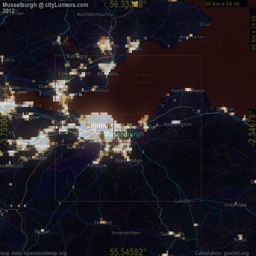
» Earth at Night: Flat Maps 2012, 2016