Newhaven night lights from space
Night Light of Newhaven (England) from space (United Kingdom) Src. Average luminocity for 10x10km area is 10.0224% and for 50x50km: 5.9543%.
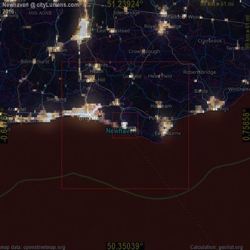
Analysis of Newhaven night lights 2016
Square area 10x10 km:
 1.4%
1.4%90-99
0.84%80-89
0.56%70-79
0.56%60-69
1.12%50-59
2.52%40-49
2.38%30-39
2.38%20-29
1.12%10-19
1.68%0-9
85.43%Square area 50x50 km:
0.6%90-99
0.84%80-89
0.57%70-79
0.7%60-69
0.72%50-59
0.86%40-49
0.99%30-39
1.04%20-29
1.66%10-19
4.63%0-9
87.39%Clear (daylight) street map image can be seen on geolist.org.
Map coordinates:
51° 14' 21.3" North, 0° 38' 51.6" West
50° 47' 48.9" North, 0° 3' 19.6" East
50° 21' 1.4" North, 0° 45' 30.9" East
Some cities around Newhaven sort by population:
• Brighton
14.1 km =8.8 mi,  284°
284°
• Eastbourne
16.4 km =10.2 mi,  101°
101°
• Hove
16.1 km =10 mi, 283°
• Seaford
4.4 km =2.7 mi,  130°
130°
• Rottingdean
8.2 km =5.1 mi, 280°
• Hailsham
16 km =9.9 mi,  62°
62°
• Peacehaven
4.4 km =2.7 mi,  263°
263°
• Lewes
9.2 km =5.7 mi,  339°
339°
2641637 (p: 13,222)
Sources (retrieved 2019-11-25):
» Earth at Night: Flat Maps 2012, 2016