Lymington night lights from space
Night Light of Lymington (England) from space (United Kingdom) Src. Average luminocity for 10x10km area is 3.6524% and for 50x50km: 10.237%.
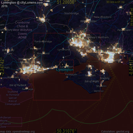
Analysis of Lymington night lights 2016
Square area 10x10 km:
 0%
0%90-99
0%80-89
0%70-79
0.13%60-69
2.81%50-59
0.8%40-49
0.53%30-39
0.4%20-29
0.67%10-19
1.07%0-9
93.58%Square area 50x50 km:
1.17%90-99
1.73%80-89
0.81%70-79
1.05%60-69
1.73%50-59
1.62%40-49
1.83%30-39
2.04%20-29
3.25%10-19
6.35%0-9
78.43%Clear (daylight) street map image can be seen on geolist.org.
Map coordinates:
51° 12' 1.3" North, 2° 14' 50.7" West
50° 45' 27.6" North, 1° 32' 39.5" West
50° 18' 38.7" North, 0° 50' 28.2" West
Some cities around Lymington sort by population:
• Christchurch
16.8 km =10.4 mi,  261°
261°
• Totton
18.3 km =11.4 mi,  11°
11°
• New Milton
8.5 km =5.3 mi,  268°
268°
• Cowes
17.4 km =10.8 mi,  88°
88°
• Hythe
15.2 km =9.4 mi,  41°
41°
• Freshwater
8.3 km =5.2 mi,  171°
171°
• East Cowes
18 km =11.2 mi, 89°
• Marchwood
16 km =9.9 mi,  23°
23°
2643312 (p: 16,446)
Sources (retrieved 2019-11-25):
» Earth at Night: Flat Maps 2012, 2016