Hythe night lights from space
Night Light of Hythe (England) from space (United Kingdom) Src. Average luminocity for 10x10km area is 37.0308% and for 50x50km: 12.3776%.
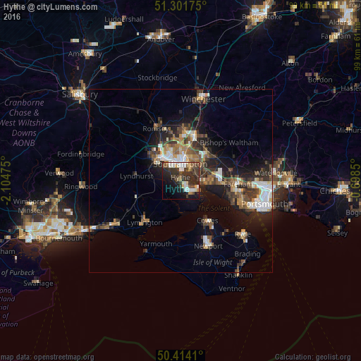
Analysis of Hythe night lights 2016
Square area 10x10 km:
 6.3%
6.3%90-99
7%80-89
1.4%70-79
3.22%60-69
3.36%50-59
4.48%40-49
7.7%30-39
13.59%20-29
18.35%10-19
18.63%0-9
15.97%Square area 50x50 km:
1.78%90-99
2.13%80-89
0.84%70-79
1.1%60-69
1.7%50-59
1.97%40-49
2.2%30-39
2.8%20-29
3.62%10-19
7.86%0-9
74.01%Clear (daylight) street map image can be seen on geolist.org.
Map coordinates:
51° 18' 6.3" North, 2° 6' 17.1" West
50° 51' 36.1" North, 1° 24' 5.8" West
50° 24' 50.8" North, 0° 41' 54.6" West
Some cities around Hythe sort by population:
• Southampton
4.9 km =3 mi,  357°
357°
• Eastleigh
12.4 km =7.7 mi,  16°
16°
• Totton
9 km =5.6 mi,  316°
316°
• Hedge End
9.2 km =5.7 mi,  50°
50°
• Bishopstoke
12.9 km =8 mi, 23°
• Bursledon
6.7 km =4.2 mi,  63°
63°
• Netley
3.8 km =2.4 mi, 61°
• Marchwood
5 km =3.1 mi,  311°
311°
2646317 (p: 20,201)
Sources (retrieved 2019-11-25):
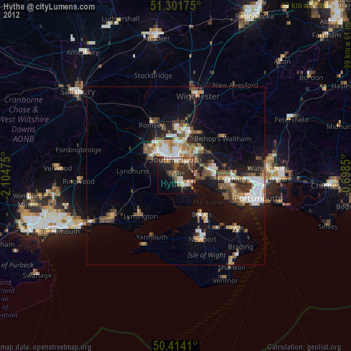
» Earth at Night: Flat Maps 2012, 2016