Dukinfield night lights from space
Night Light of Dukinfield (England) from space (United Kingdom) Src. Average luminocity for 10x10km area is 80.5066% and for 50x50km: 35.3411%.
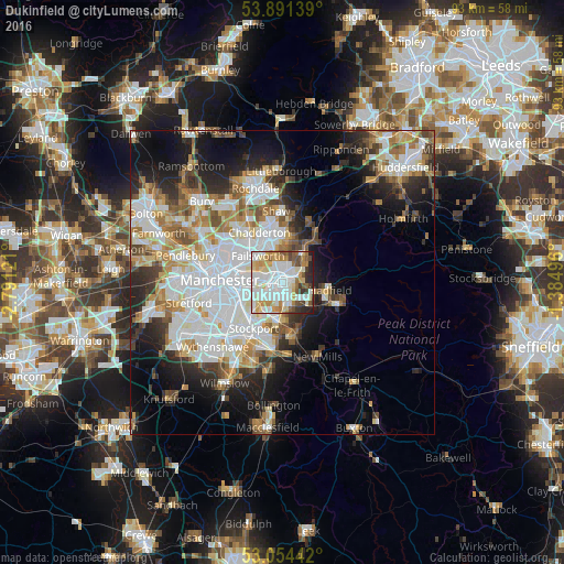
Analysis of Dukinfield night lights 2016
Square area 10x10 km:
 27.12%
90-99
24.87%80-89
10.85%70-79
9.92%60-69
5.95%50-59
7.28%40-49
4.76%30-39
4.5%20-29
4.63%10-19
0.13%0-9
0%Square area 50x50 km:
10.54%90-99
8.01%80-89
3.45%70-79
3.62%60-69
4.34%50-59
3.75%40-49
3.24%30-39
3.65%20-29
6.51%10-19
10.81%0-9
42.08%Clear (daylight) street map image can be seen on geolist.org.
Map coordinates:
53° 53' 29" North, 2° 47' 28.4" West
53° 28' 29.9" North, 2° 5' 17.1" West
53° 3' 15.9" North, 1° 23' 5.9" West
Some cities around Dukinfield sort by population:
• Ashton-under-Lyne
1.7 km =1.1 mi,  334°
334°
• Hyde
2.7 km =1.7 mi,  167°
167°
• Denton
2.8 km =1.7 mi,  224°
224°
• Droylsden
3.8 km =2.4 mi,  278°
278°
• Stalybridge
2.2 km =1.4 mi,  62°
62°
• Mossley
5.6 km =3.5 mi,  38°
38°
• Haughton Green
3.8 km =2.4 mi,  190°
190°
• Longdendale
5.9 km =3.7 mi,  98°
98°
2650815 (p: 19,306)
Sources (retrieved 2019-11-25):
» Earth at Night: Flat Maps 2012, 2016