Eastleigh night lights from space
Night Light of Eastleigh (England) from space (United Kingdom) Src. Average luminocity for 10x10km area is 39.4832% and for 50x50km: 12.2397%.
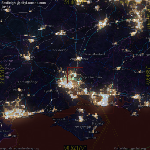
Analysis of Eastleigh night lights 2016
Square area 10x10 km:
 2.24%
2.24%90-99
5.46%80-89
4.76%70-79
5.04%60-69
7.56%50-59
9.66%40-49
10.08%30-39
7.84%20-29
12.89%10-19
21.71%0-9
12.75%Square area 50x50 km:
1.69%90-99
2.06%80-89
0.84%70-79
1.11%60-69
1.66%50-59
1.95%40-49
2.4%30-39
2.82%20-29
4%10-19
7.93%0-9
73.54%Clear (daylight) street map image can be seen on geolist.org.
Map coordinates:
51° 24' 26.5" North, 2° 3' 11.2" West
50° 58' 0" North, 1° 21' 0" West
50° 31' 18.3" North, 0° 38' 48.7" West
Some cities around Eastleigh sort by population:
• Southampton
7.9 km =4.9 mi,  208°
208°
• Hedge End
7 km =4.3 mi,  150°
150°
• Bishopstoke
1.5 km =0.9 mi,  91°
91°
• Romsey
10.8 km =6.7 mi,  283°
283°
• Bursledon
9.2 km =5.7 mi,  165°
165°
• North Baddesley
6.8 km =4.2 mi, 280°
• Netley
10 km =6.2 mi,  181°
181°
• Bishops Waltham
9.5 km =5.9 mi,  97°
97°
2650396 (p: 54,225)
Sources (retrieved 2019-11-25):
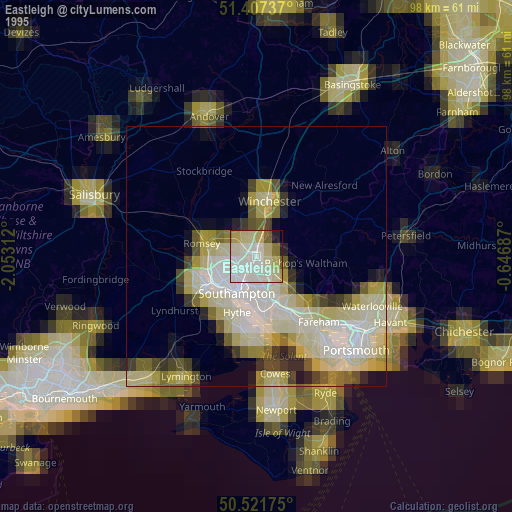
» NASA, Earths city lights 1995
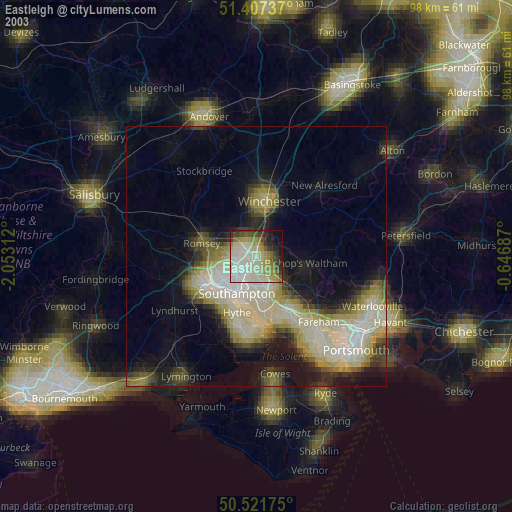
» NASA city lights 2003
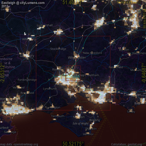
» Earth at Night: Flat Maps 2012, 2016