Hinckley night lights from space
Night Light of Hinckley (England) from space (United Kingdom) Src. Average luminocity for 10x10km area is 31.3042% and for 50x50km: 24.6493%.
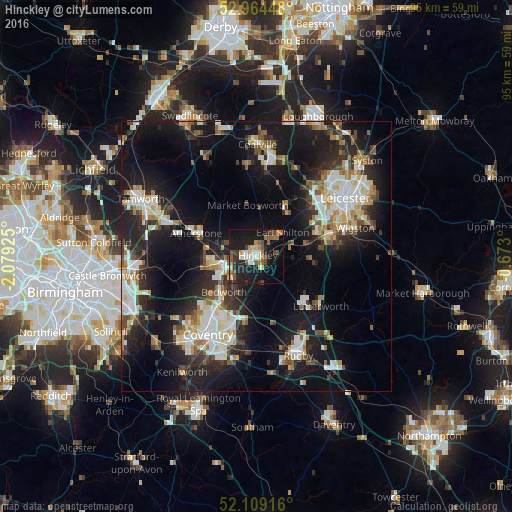
Analysis of Hinckley night lights 2016
Square area 10x10 km:
 3.7%
3.7%90-99
3.97%80-89
3.31%70-79
2.65%60-69
5.69%50-59
6.35%40-49
5.29%30-39
2.51%20-29
10.71%10-19
36.51%0-9
19.31%Square area 50x50 km:
4.07%90-99
5%80-89
2.33%70-79
2.23%60-69
2.91%50-59
2.7%40-49
2.85%30-39
3.3%20-29
8.07%10-19
21.18%0-9
45.37%Clear (daylight) street map image can be seen on geolist.org.
Map coordinates:
52° 57' 52.1" North, 2° 4' 45.3" West
52° 32' 20" North, 1° 22' 34.1" West
52° 6' 33" North, 0° 40' 22.8" West
Some cities around Hinckley sort by population:
• Nuneaton
6.3 km =3.9 mi,  253°
253°
• Bedworth
9.2 km =5.7 mi,  223°
223°
• Earl Shilton
5.9 km =3.7 mi,  44°
44°
• Hartshill
9.9 km =6.2 mi,  276°
276°
• Atherstone
12.2 km =7.6 mi,  289°
289°
• Attleborough
6.1 km =3.8 mi,  241°
241°
• Broughton Astley
10.8 km =6.7 mi,  96°
96°
• Narborough
12.3 km =7.6 mi,  75°
75°
2646867 (p: 45,249)
Sources (retrieved 2019-11-25):
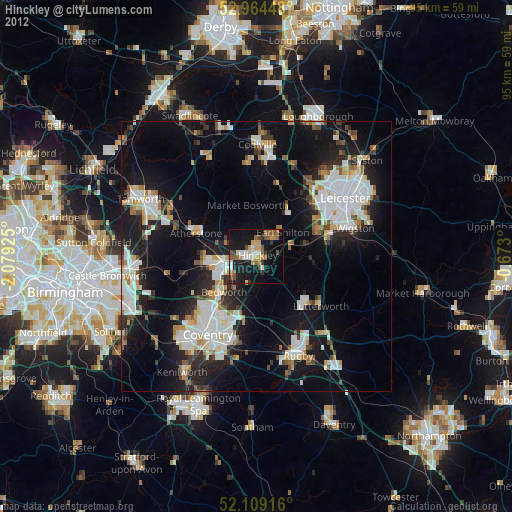
» Earth at Night: Flat Maps 2012, 2016