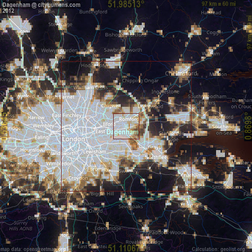
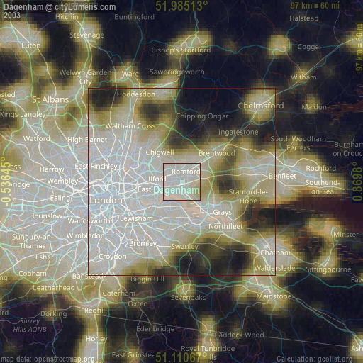
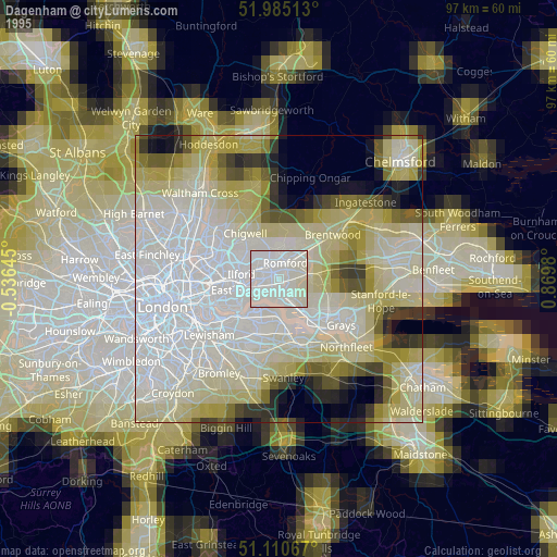
Dagenham night lights from space
Night Light of Dagenham (England) from space (United Kingdom) Src. Average luminocity for 10x10km area is 88.4987% and for 50x50km: 55.7338%.
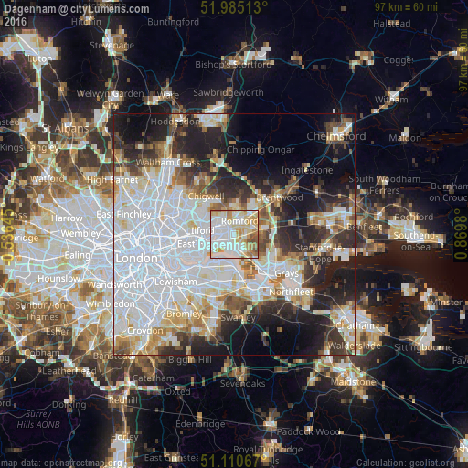
Analysis of Dagenham night lights 2016
Square area 10x10 km:
 33.42%
90-99
26.34%80-89
16.18%70-79
10.43%60-69
7.09%50-59
5.08%40-49
1.47%30-39
0%20-29
0%10-19
0%0-9
0%Square area 50x50 km:
21.92%90-99
12.39%80-89
5.67%70-79
4.54%60-69
4.56%50-59
4.43%40-49
4.42%30-39
5.01%20-29
9.11%10-19
12.85%0-9
15.1%Clear (daylight) street map image can be seen on geolist.org.
Map coordinates:
51° 59' 6.5" North, 0° 32' 11.2" West
51° 33' 0" North, 0° 10' 0" East
51° 6' 38.4" North, 0° 52' 11.3" East
Some cities around Dagenham sort by population:
• Becontree
2.6 km =1.6 mi,  277°
277°
• Romford
3.1 km =1.9 mi,  25°
25°
• Barking
6.1 km =3.8 mi,  252°
252°
• Hornchurch
3.5 km =2.2 mi,  77°
77°
• Elm Park
2.4 km =1.5 mi,  90°
90°
• Collier Row
5.4 km =3.4 mi,  359°
359°
• Upminster
6.2 km =3.9 mi, 83°
• Chadwell Heath
3.3 km =2.1 mi,  315°
315°
2651621 (p: 108,368)
Sources (retrieved 2019-11-25):
» NASA, Earths city lights 1995
» NASA city lights 2003
» Earth at Night: Flat Maps 2012, 2016