Four Marks night lights from space
Night Light of Four Marks (England) from space (United Kingdom) Src. Average luminocity for 10x10km area is 0.1671% and for 50x50km: 8.2094%.
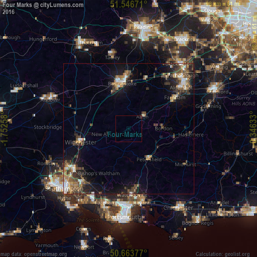
Analysis of Four Marks night lights 2016
Square area 10x10 km:
 0%
0%90-99
0%80-89
0%70-79
0%60-69
0%50-59
0%40-49
0%30-39
0%20-29
0%10-19
0.8%0-9
99.2%Square area 50x50 km:
0.76%90-99
1.13%80-89
0.54%70-79
0.88%60-69
1.25%50-59
1.41%40-49
1.96%30-39
1.95%20-29
2.25%10-19
6.14%0-9
81.73%Clear (daylight) street map image can be seen on geolist.org.
Map coordinates:
51° 32' 48.2" North, 1° 45' 9.3" West
51° 6' 26.5" North, 1° 2' 58" West
50° 39' 49.6" North, 0° 20' 46.8" West
Some cities around Four Marks sort by population:
• Basingstoke
17.4 km =10.8 mi,  351°
351°
• Winchester
19.4 km =12.1 mi,  255°
255°
• Bordon
13.1 km =8.1 mi,  86°
86°
• Alton
7 km =4.3 mi,  48°
48°
• Petersfield
14 km =8.7 mi,  144°
144°
• Liphook
17.5 km =10.9 mi,  101°
101°
• Liss
13.1 km =8.1 mi,  123°
123°
• New Alresford
8.7 km =5.4 mi,  254°
254°
2649132 (p: 5,674)
Sources (retrieved 2019-11-25):
» Earth at Night: Flat Maps 2012, 2016