New Alresford night lights from space
Night Light of New Alresford (England) from space (United Kingdom) Src. Average luminocity for 10x10km area is 0.0976% and for 50x50km: 9.7525%.
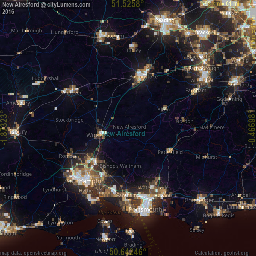
Analysis of New Alresford night lights 2016
Square area 10x10 km:
 0%
0%90-99
0%80-89
0%70-79
0%60-69
0%50-59
0%40-49
0%30-39
0%20-29
0%10-19
0.53%0-9
99.47%Square area 50x50 km:
1.05%90-99
1.4%80-89
0.61%70-79
0.94%60-69
1.58%50-59
1.89%40-49
1.82%30-39
2.4%20-29
2.86%10-19
6.76%0-9
78.68%Clear (daylight) street map image can be seen on geolist.org.
Map coordinates:
51° 31' 32.9" North, 1° 52' 23.6" West
51° 5' 10.5" North, 1° 10' 12.4" West
50° 38' 32.9" North, 0° 28' 1.1" West
Some cities around New Alresford sort by population:
• Eastleigh
18.3 km =11.4 mi,  223°
223°
• Winchester
10.6 km =6.6 mi,  257°
257°
• Bishopstoke
17.3 km =10.7 mi, 219°
• Alton
15.3 km =9.5 mi,  62°
62°
• Petersfield
18.8 km =11.7 mi,  118°
118°
• Bishops Waltham
14.8 km =9.2 mi,  192°
192°
• Liss
20 km =12.4 mi,  103°
103°
• Four Marks
8.7 km =5.4 mi,  74°
74°
2641736 (p: 5,431)
Sources (retrieved 2019-11-25):
» Earth at Night: Flat Maps 2012, 2016