Edinburgh night lights from space
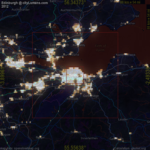
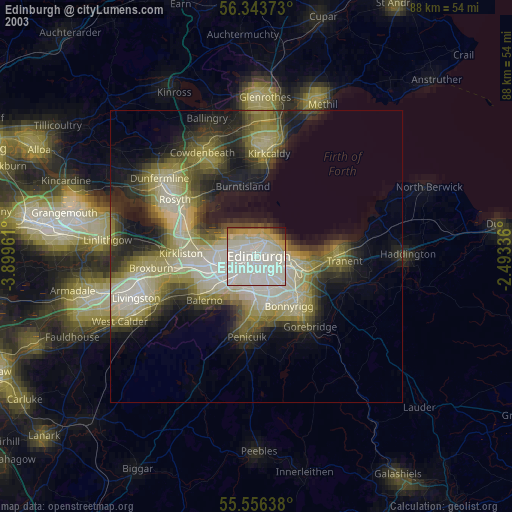
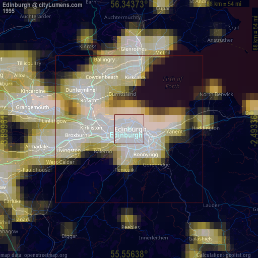
Night Light of Edinburgh (Scotland) from space (United Kingdom) Src. Average luminocity for 10x10km area is 85.9975% and for 50x50km: 16.5957%.
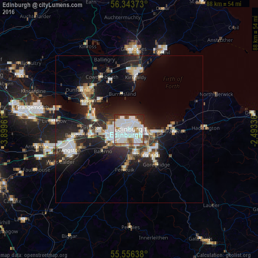
Analysis of Edinburgh night lights 2016
Square area 10x10 km:
 37.47%
90-99
35.59%80-89
4.39%70-79
2.01%60-69
3.13%50-59
4.01%40-49
2.63%30-39
5.89%20-29
4.64%10-19
0.25%0-9
0%Square area 50x50 km:
3.59%90-99
3.82%80-89
1.49%70-79
1.21%60-69
1.45%50-59
1.39%40-49
1.53%30-39
2.07%20-29
6.7%10-19
10.61%0-9
66.14%Clear (daylight) street map image can be seen on geolist.org.
Map coordinates:
56° 20' 37.4" North, 3° 53' 58.6" West
55° 57' 7.4" North, 3° 11' 47.3" West
55° 33' 23" North, 2° 29' 36.1" West
Some cities around Edinburgh sort by population:
• Musselburgh
9.2 km =5.7 mi,  97°
97°
• Bonnyrigg
10.4 km =6.5 mi,  146°
146°
• Dalkeith
10.3 km =6.4 mi,  129°
129°
• Colinton
6.2 km =3.9 mi,  216°
216°
• Currie
9.3 km =5.8 mi,  228°
228°
• Burntisland
12.1 km =7.5 mi,  348°
348°
• Loanhead
8.4 km =5.2 mi,  163°
163°
• Balerno
11.7 km =7.3 mi, 229°
2650225 (p: 464,990)
Sources (retrieved 2019-11-25):
» NASA, Earths city lights 1995
» NASA city lights 2003
» Earth at Night: Flat Maps 2012, 2016