Eaton Socon night lights from space
Night Light of Eaton Socon (England) from space (United Kingdom) Src. Average luminocity for 10x10km area is 16.1905% and for 50x50km: 8.4295%.
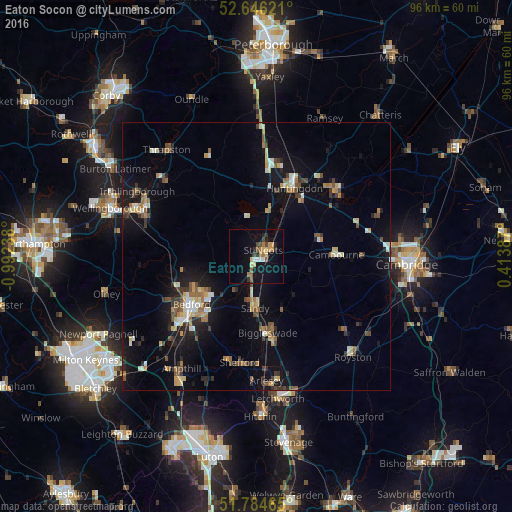
Analysis of Eaton Socon night lights 2016
Square area 10x10 km:
 1.19%
1.19%90-99
1.19%80-89
2.78%70-79
2.12%60-69
3.31%50-59
1.72%40-49
2.65%30-39
1.32%20-29
2.78%10-19
15.74%0-9
65.21%Square area 50x50 km:
0.64%90-99
0.94%80-89
1.07%70-79
0.92%60-69
1.15%50-59
1.12%40-49
1.27%30-39
1.2%20-29
1.59%10-19
7.31%0-9
82.79%Clear (daylight) street map image can be seen on geolist.org.
Map coordinates:
52° 38' 46.4" North, 0° 59' 32.6" West
52° 13' 3.1" North, 0° 17' 21.3" West
51° 47' 4.7" North, 0° 24' 49.9" East
Some cities around Eaton Socon sort by population:
• Bedford
15.2 km =9.4 mi,  232°
232°
• Saint Neots
1.5 km =0.9 mi,  93°
93°
• Huntingdon
14.4 km =8.9 mi,  29°
29°
• Kempston
18.3 km =11.4 mi, 231°
• Biggleswade
14.7 km =9.1 mi,  173°
173°
• Sandy
9.8 km =6.1 mi,  180°
180°
• Cambourne
14.9 km =9.3 mi, 88°
• Godmanchester
13.7 km =8.5 mi, 34°
2650293 (p: 12,712)
Sources (retrieved 2019-11-25):
» Earth at Night: Flat Maps 2012, 2016