Bedford night lights from space
Night Light of Bedford (England) from space (United Kingdom) Src. Average luminocity for 10x10km area is 44.3175% and for 50x50km: 15.5003%.
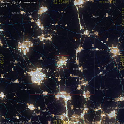
Analysis of Bedford night lights 2016
Square area 10x10 km:
 7.14%
7.14%90-99
8.86%80-89
5.16%70-79
6.35%60-69
7.41%50-59
4.5%40-49
6.22%30-39
6.22%20-29
12.43%10-19
27.38%0-9
8.33%Square area 50x50 km:
2.68%90-99
2.62%80-89
1.46%70-79
1.29%60-69
1.61%50-59
1.75%40-49
1.84%30-39
1.87%20-29
4.15%10-19
13.97%0-9
66.76%Clear (daylight) street map image can be seen on geolist.org.
Map coordinates:
52° 33' 50.7" North, 1° 10' 10" West
52° 8' 4.5" North, 0° 27' 58.8" West
51° 42' 3.3" North, 0° 14' 12.5" East
Some cities around Bedford sort by population:
• Ampthill
12.1 km =7.5 mi,  189°
189°
• Kempston Hardwick
5.5 km =3.4 mi,  204°
204°
• Kempston
3.1 km =1.9 mi,  228°
228°
• Biggleswade
14.8 km =9.2 mi,  111°
111°
• Flitwick
14.7 km =9.1 mi, 187°
• Sandy
12.1 km =7.5 mi,  92°
92°
• Shefford
14 km =8.7 mi,  139°
139°
• Cranfield
12.2 km =7.6 mi, 233°
2656046 (p: 106,940)
Sources (retrieved 2019-11-25):
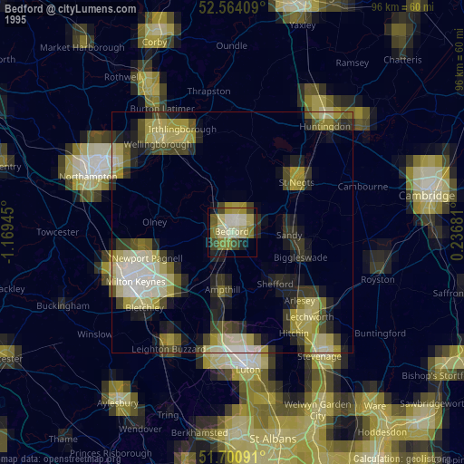
» NASA, Earths city lights 1995
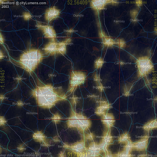
» NASA city lights 2003
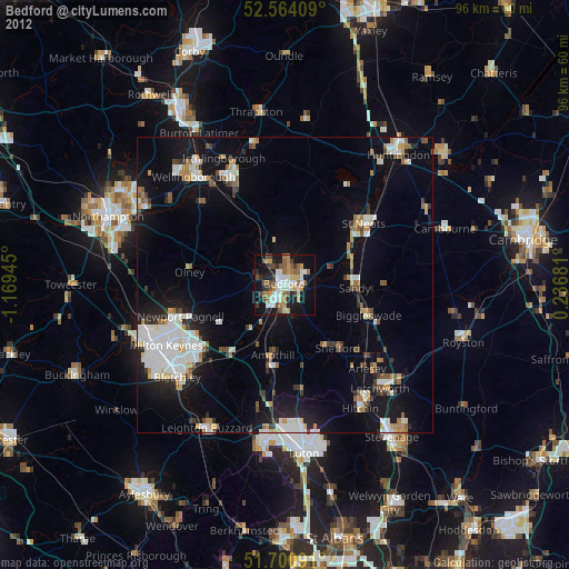
» Earth at Night: Flat Maps 2012, 2016